MyTopo
Nehasane Lake New York US Topo Map
Couldn't load pickup availability
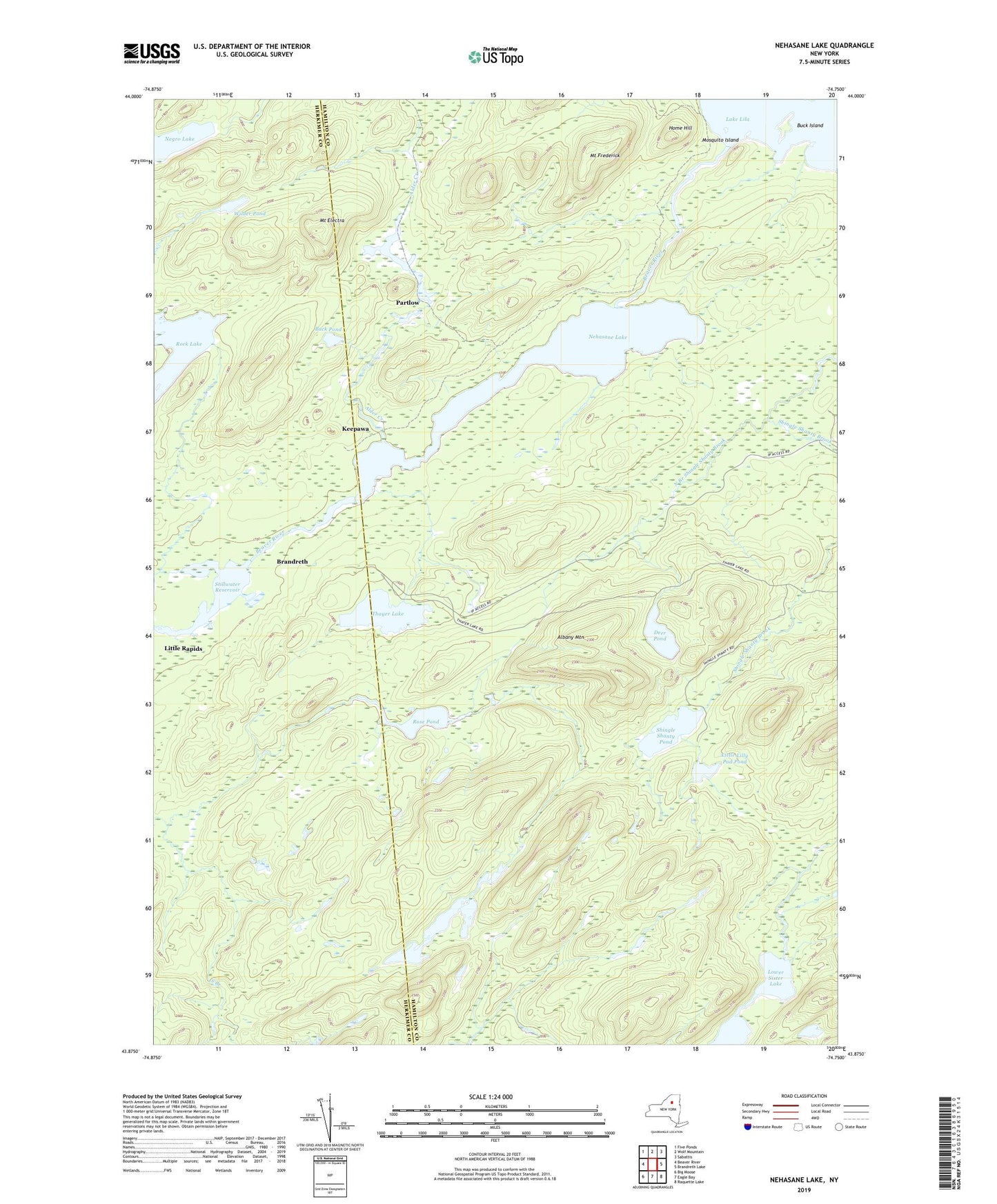
2019 topographic map quadrangle Nehasane Lake in the state of New York. Scale: 1:24000. Based on the newly updated USGS 7.5' US Topo map series, this map is in the following counties: Hamilton, Herkimer. The map contains contour data, water features, and other items you are used to seeing on USGS maps, but also has updated roads and other features. This is the next generation of topographic maps. Printed on high-quality waterproof paper with UV fade-resistant inks.
Quads adjacent to this one:
West: Beaver River
Northwest: Five Ponds
North: Wolf Mountain
Northeast: Sabattis
East: Brandreth Lake
Southeast: Raquette Lake
South: Eagle Bay
Southwest: Big Moose
Contains the following named places: Albany Mountain, Alder Creek, Brandreth, Buck Island, Buck Pond, Deer Pond, Home Hill, Keepawa, Little Lilly Pad Pond, Little Rapids, Lower Sister Lake, Mosquito Island, Mount Electra, Mount Frederick, Negro Lake, Nehasane Lake, North Branch Shingle Shanty Brook, Partlow, Rock Lake, Rose Pond, Shingle Shanty Pond, Terror Lake, Thayer Lake, Upper Sister Lake, Wigwam Point, Wilder Pond