MyTopo
Peck Lake New York US Topo Map
Couldn't load pickup availability
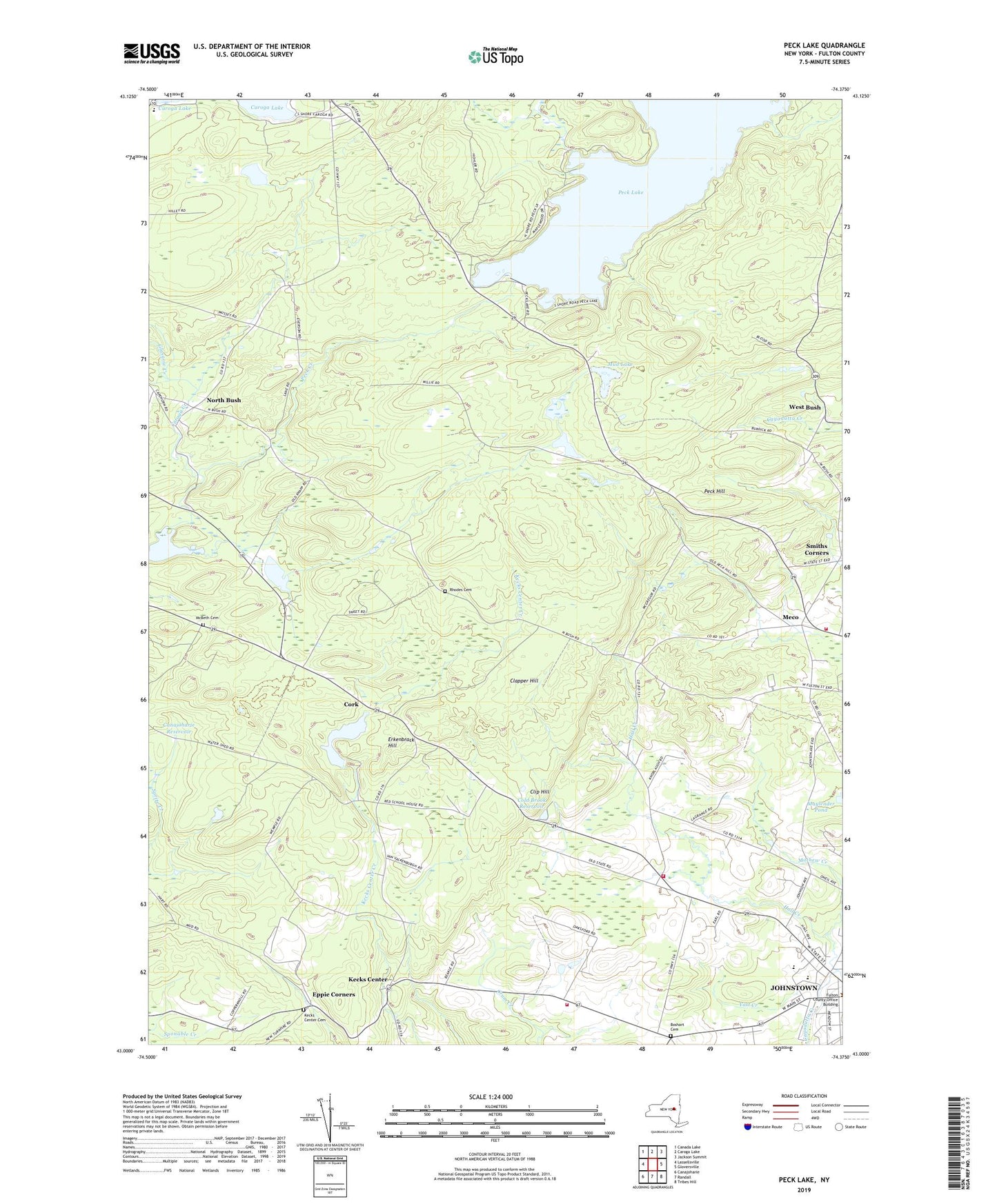
2023 topographic map quadrangle Peck Lake in the state of New York. Scale: 1:24000. Based on the newly updated USGS 7.5' US Topo map series, this map is in the following counties: Fulton. The map contains contour data, water features, and other items you are used to seeing on USGS maps, but also has updated roads and other features. This is the next generation of topographic maps. Printed on high-quality waterproof paper with UV fade-resistant inks.
Quads adjacent to this one:
West: Lassellsville
Northwest: Canada Lake
North: Caroga Lake
Northeast: Jackson Summit
East: Gloversville
Southeast: Tribes Hill
South: Randall
Southwest: Canajoharie
This map covers the same area as the classic USGS quad with code o43074a4.
Contains the following named places: Boshart Cemetery, Canajoharie Reservoir, Church of the Immaculate Conception, City of Johnstown, Clapper Hill, Clip Hill, Clip Hill School, Cold Brook Reservoir, Cork, Cork Center Reservoir, Crossroads School, Deer Creek Mobile Home Park, East Caroga Lake Camping Area, Eppie Corners, Erkenbrack Hill, Faith Tabernacle, Fulton County, Glasgow Creek, Hall Creek, Johnstown Hospital, Johnstown Senior High School, Kecks Center, Kecks Center Cemetery, Mathew Creek, McBeth Cemetery, Meco, Meco Volunteer Fire Department, Mud Lake, North Bush, North Bush Church, Peck Creek, Peck Hill, Peck Lake, Pineview Commons Home for Adults, Rhodes Cemetery, Rockwood Lake, Rogers Family Orchards, Sampsonsville Volunteer Fire Department, School Number 17, Scotchbush School, Sir William Johnson State Park, Sir William Johnson Volunteer Fire Department, Smiths Corners, Town of Johnstown, Warren Street Elementary School, Wells House, Wells Nursing Home, Wemple School, West Bush, Wheelerville Union Free School, WSRD-FM (Johnstown), Yost Creek, ZIP Code: 12095