MyTopo
Lassellsville New York US Topo Map
Couldn't load pickup availability
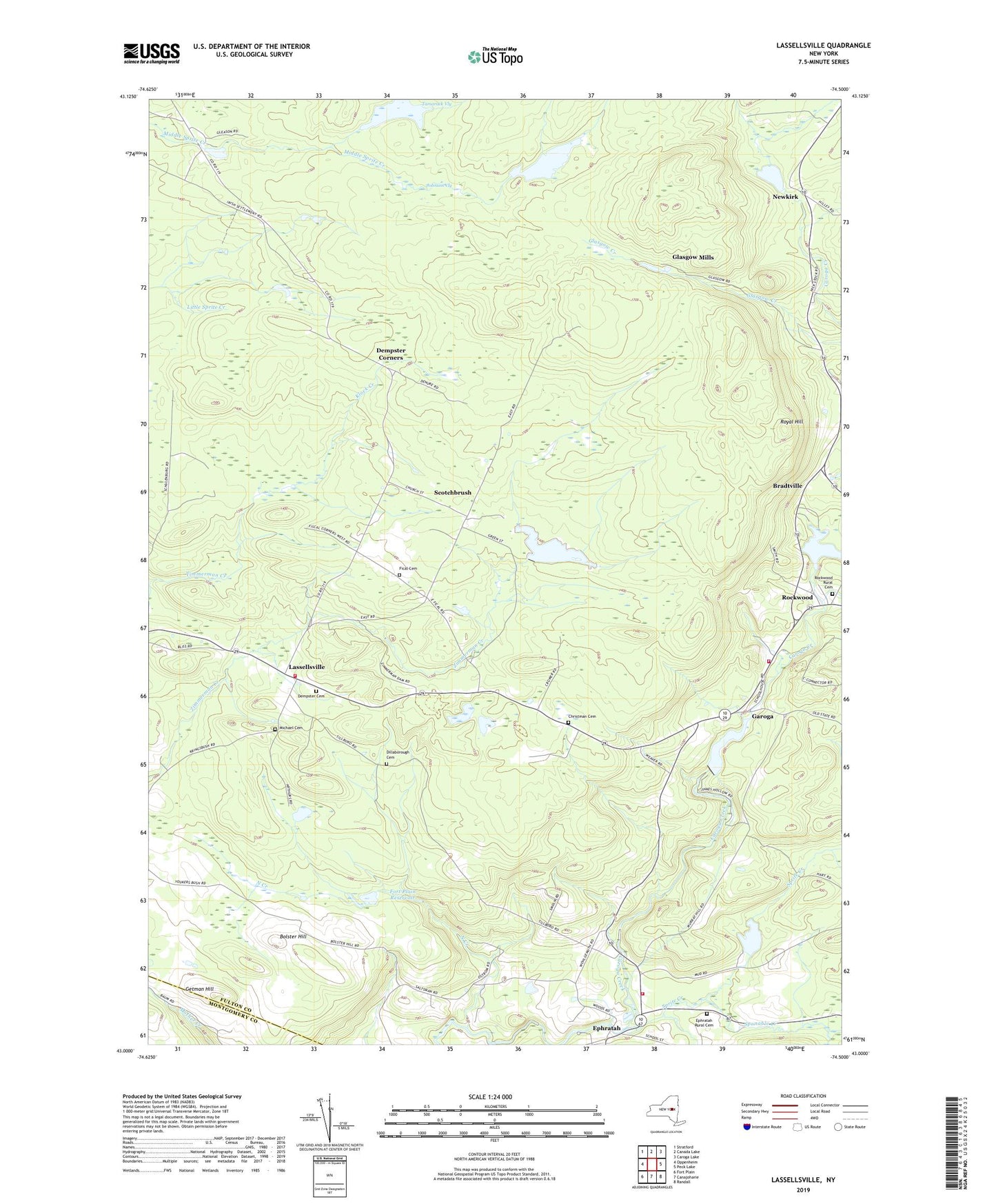
2023 topographic map quadrangle Lassellsville in the state of New York. Scale: 1:24000. Based on the newly updated USGS 7.5' US Topo map series, this map is in the following counties: Fulton, Montgomery. The map contains contour data, water features, and other items you are used to seeing on USGS maps, but also has updated roads and other features. This is the next generation of topographic maps. Printed on high-quality waterproof paper with UV fade-resistant inks.
Quads adjacent to this one:
West: Oppenheim
Northwest: Stratford
North: Canada Lake
Northeast: Caroga Lake
East: Peck Lake
Southeast: Randall
South: Canajoharie
Southwest: Fort Plain
This map covers the same area as the classic USGS quad with code o43074a5.
Contains the following named places: Acadian Farm, Adirondack State Park, Bolster Hill, Bradtville, Christman Cemetery, Dempster Cemetery, Dempster Corners, Dillaborough Cemetery, Ephratah, Ephratah Rural Cemetery, Ephratah Volunteer Fire Department, Fical Cemetery, Fical Corners, Fort Plain Reservoir, Garoga, Getman Hill, Glasgow Mills, Hillabrandt Vly, Johnson Vly, Klock Creek, Lassellsville, Lassellsville Fire House Volunteer Company, Michael Cemetery, Miles School, Mud Road Farm, Newkirk, North Creek, Rockwood, Rockwood - Garoga - Lassellsville Volunteer Fire Company Station 2, Rockwood Fire Station, Rockwood Rural Cemetery, Royal Hill, Saint Johnsville Reservoir, School Number 2, Scotchbrush, Shaver School, Sponable Creek, Sprite Creek, Tamarack Vly, Town of Ephratah, ZIP Code: 12032