MyTopo
Canada Lake New York US Topo Map
Couldn't load pickup availability
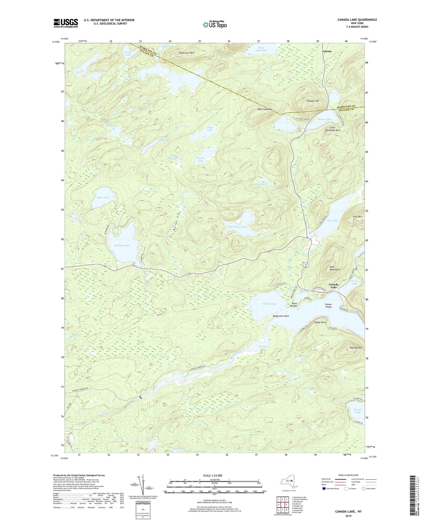
2023 topographic map quadrangle Canada Lake in the state of New York. Scale: 1:24000. Based on the newly updated USGS 7.5' US Topo map series, this map is in the following counties: Fulton, Hamilton. The map contains contour data, water features, and other items you are used to seeing on USGS maps, but also has updated roads and other features. This is the next generation of topographic maps. Printed on high-quality waterproof paper with UV fade-resistant inks.
Quads adjacent to this one:
West: Stratford
Northwest: Morehouse Lake
North: Tomany Mountain
Northeast: Whitehouse
East: Caroga Lake
Southeast: Peck Lake
South: Lassellsville
Southwest: Oppenheim
This map covers the same area as the classic USGS quad with code o43074b5.
Contains the following named places: Arietta, Ayers Lake, Broomstick Lake, Burnt Vly, Canada Lake, Dexter Lake, Dolgeville Point, Fourth Lake, Good Luck Lake, Good Luck Mountain, Goose Egg Lake, Green Lake, Kane Mountains, Knapps Long Lake, Lily Lake, Little Roundtop Mountain, Long Lake, Long Pond, Mud Lake, Negro Lake, Nine Corner Lake, Pine Lake, Pine Lake Campground and Recreational Vehicle Park, Pine Lake Mobile Home Park, Pine Mountain, Pleasant Lake, Point Breeze, Rooster Hill, Sandy Point, Sheeley Mountain, Southern Adirondack Pines Campground and Cabins, Spectacle Lake, Stewart Landing, Stoner Island, Stoner Lakes, Third Lake, Town of Caroga, Waters Millpond, West Lake, West Lake Mountain, ZIP Code: 13470