MyTopo
Philadelphia New York US Topo Map
Couldn't load pickup availability
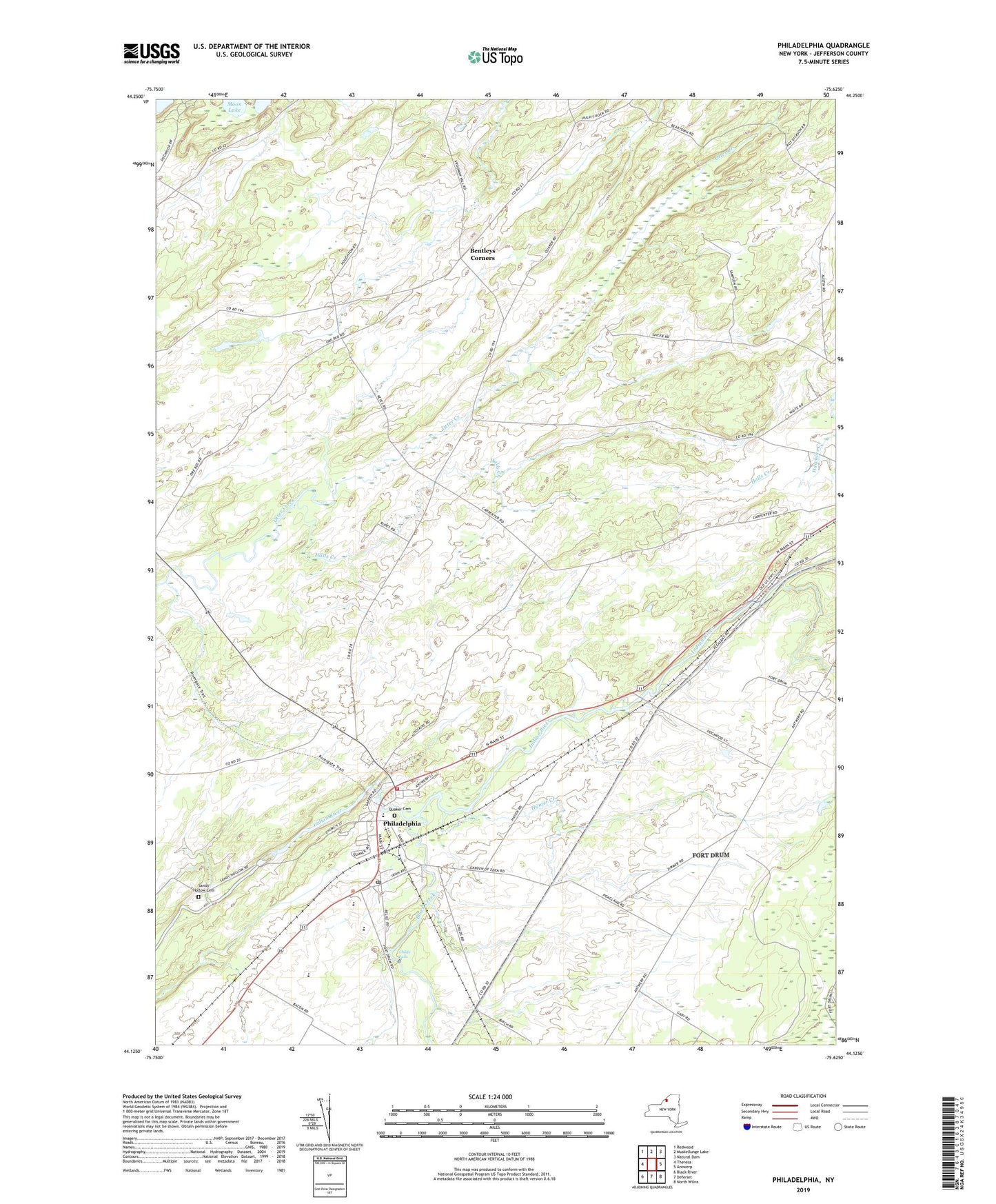
2019 topographic map quadrangle Philadelphia in the state of New York. Scale: 1:24000. Based on the newly updated USGS 7.5' US Topo map series, this map is in the following counties: Jefferson. The map contains contour data, water features, and other items you are used to seeing on USGS maps, but also has updated roads and other features. This is the next generation of topographic maps. Printed on high-quality waterproof paper with UV fade-resistant inks.
Quads adjacent to this one:
West: Theresa
Northwest: Redwood
North: Muskellunge Lake
Northeast: Natural Dam
East: Antwerp
Southeast: North Wilna
South: Deferiet
Southwest: Black River
Contains the following named places: Bentleys Corners, Bishops Corners, Black Creek, Bodman Memorial Library, Childs Falls, Halls Corner, Halls Creek, Hunter Creek, Indian River Baptist Church, Indian River High School, Indian River Intermediate School, Indian River Middle School, Philadelphia, Philadelphia Fire Department, Philadelphia Post Office, Philadelphia United Methodist Church, Philadelphia Village Wastewater Treatment Plant, Quaker Cemetery, Sandy Hollow Cemetery, School Number 4, School Number 5, School Number 6, School Number 8, School Number 9, Town of Philadelphia, Village of Philadelphia, ZIP Code: 13673