MyTopo
Pierrepont New York US Topo Map
Couldn't load pickup availability
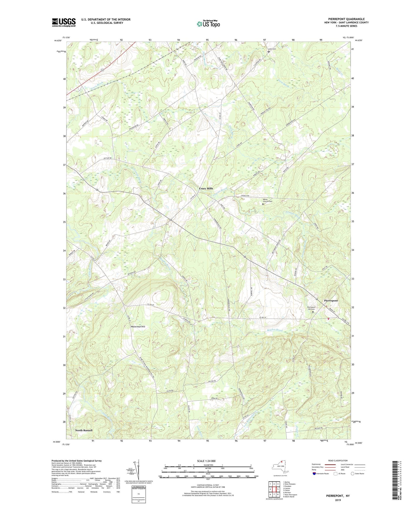
2023 topographic map quadrangle Pierrepont in the state of New York. Scale: 1:24000. Based on the newly updated USGS 7.5' US Topo map series, this map is in the following counties: St. Lawrence. The map contains contour data, water features, and other items you are used to seeing on USGS maps, but also has updated roads and other features. This is the next generation of topographic maps. Printed on high-quality waterproof paper with UV fade-resistant inks.
Quads adjacent to this one:
West: Canton
Northwest: Morley
North: West Potsdam
Northeast: Potsdam
East: Colton
Southeast: Albert Marsh
South: West Pierrepont
Southwest: Hermon
This map covers the same area as the classic USGS quad with code o44075e1.
Contains the following named places: Baldwin Branch, Beach Plains Church, Boyden Brook, Brick Chapel, Brick Chapel Church, Crary Mills, Giffins Corners School, Langdon Corners, Leet Cemetery, Leonard Brook, Maple Leaf Farm, North Russell, Pierrepoint Volunteer Fire Company, Pierrepont, Pierrepont Hill Cemetery, Taylor Creek, Town of Pierrepont, Waterman Hill, White Church Cemetery, WSLU-FM (Canton), WVNC-FM (Canton)