MyTopo
West Potsdam New York US Topo Map
Couldn't load pickup availability
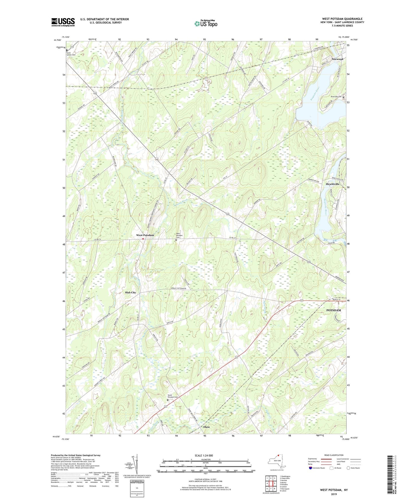
2023 topographic map quadrangle West Potsdam in the state of New York. Scale: 1:24000. Based on the newly updated USGS 7.5' US Topo map series, this map is in the following counties: St. Lawrence. The map contains contour data, water features, and other items you are used to seeing on USGS maps, but also has updated roads and other features. This is the next generation of topographic maps. Printed on high-quality waterproof paper with UV fade-resistant inks.
Quads adjacent to this one:
West: Morley
Northwest: Waddington
North: Chase Mills
Northeast: Norfolk
East: Potsdam
Southeast: Colton
South: Pierrepont
Southwest: Canton
This map covers the same area as the classic USGS quad with code o44075f1.
Contains the following named places: Burnham Corners, Dailey Ridge Church, Eben, Hewittville, Maple Street Trailer Court, Norwood Hydro-Electric Generator Station, Norwood Village Water Pollution Control Plant, Riverside Cemetery, Sagamore Farm, Saint James Cemetery, Saint Lawrence Nurseries, Slab City, South Potsdam Cemetery, Stony Brook, Sugar Creek, Thompson School, Town of Potsdam, West Potsdam, West Potsdam Cemetery, West Potsdam Volunteer Fire Department, WPDM-AM (Potsdam), WSNN-FM (Potsdam), WTSC-FM (Potsdam)