MyTopo
Ragged Lake New York US Topo Map
Couldn't load pickup availability
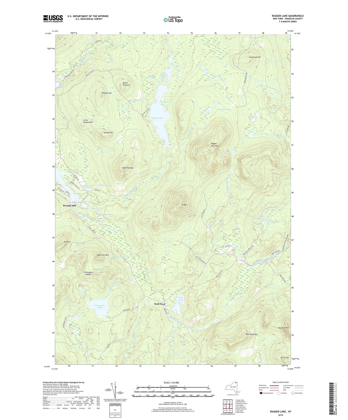
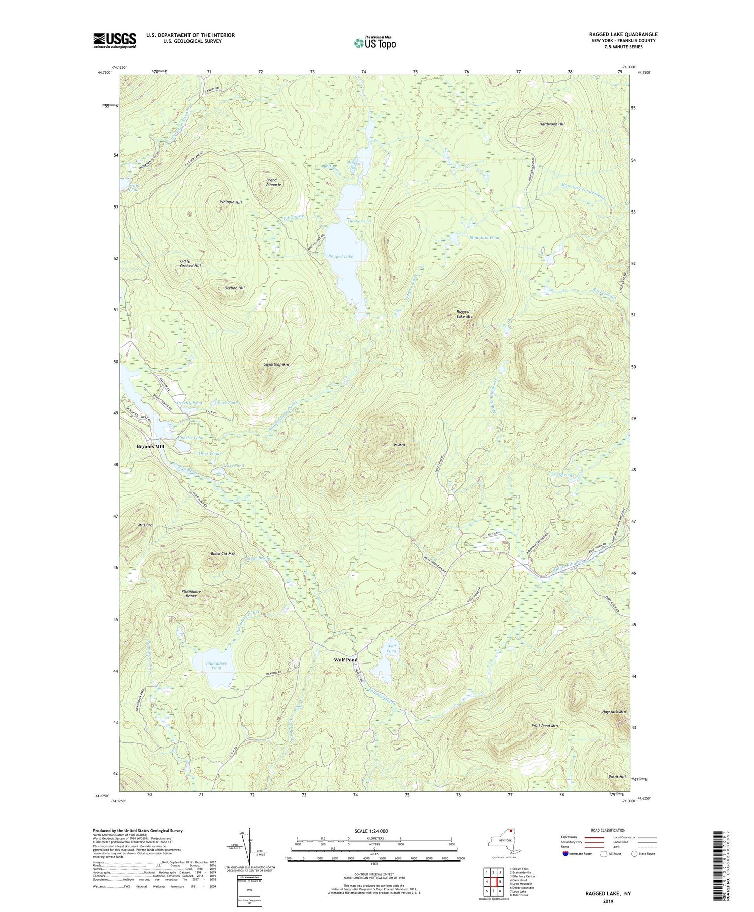
2019 topographic map quadrangle Ragged Lake in the state of New York. Scale: 1:24000. Based on the newly updated USGS 7.5' US Topo map series, this map is in the following counties: Franklin. The map contains contour data, water features, and other items you are used to seeing on USGS maps, but also has updated roads and other features. This is the next generation of topographic maps. Printed on high-quality waterproof paper with UV fade-resistant inks.
Quads adjacent to this one:
West: Owls Head
Northwest: Chasm Falls
North: Brainardsville
Northeast: Ellenburg Center
East: Lyon Mountain
Southeast: Alder Brook
South: Loon Lake
Southwest: Debar Mountain
Contains the following named places: Bell Brook, Black Cat Mountain, Brand Pinnacle, Bryants Mill, Burnt Hill, Charlie Pond, Clear Brook, Cold Brook, Deerfly Pond, Drain Pond, Duck Pond, Duck Ponds, Fender Brook, Grass Pond, Hardwood Hill, Haystack Mountain, Lily Pod Pond, Little Orebed Hill, Lost Pond, Middle Kilns, Mount Hurd, Mountain Pond, Mud Pond, Orebed Hill, Peavey Bay, Plumadore Outlet, Plumadore Pond, Ragged Lake, Ragged Lake Mountain, Ragged Lake Outlet, Sugarloaf Mountain, Tait Brook, The Beaver Dam, The Narrows, The Springs, Town of Bellmont, Upper Kilns, W Mountain, Whipple Hill, Wolf Pond, Wolf Pond Mountain, ZIP Code: 12969