MyTopo
Lyon Mountain New York US Topo Map
Couldn't load pickup availability
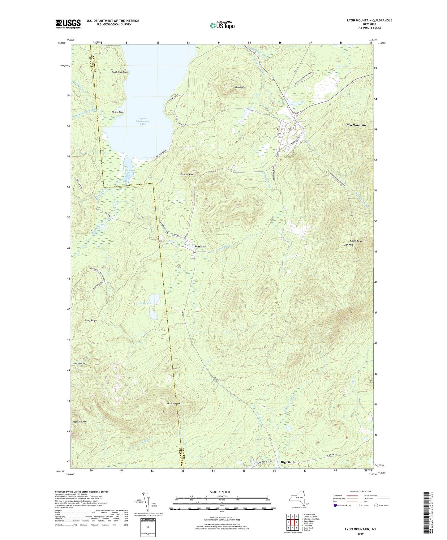
2023 topographic map quadrangle Lyon Mountain in the state of New York. Scale: 1:24000. Based on the newly updated USGS 7.5' US Topo map series, this map is in the following counties: Clinton, Franklin. The map contains contour data, water features, and other items you are used to seeing on USGS maps, but also has updated roads and other features. This is the next generation of topographic maps. Printed on high-quality waterproof paper with UV fade-resistant inks.
Quads adjacent to this one:
West: Ragged Lake
Northwest: Brainardsville
North: Ellenburg Center
Northeast: Ellenburg Mountain
East: Moffitsville
Southeast: Redford
South: Alder Brook
Southwest: Loon Lake
This map covers the same area as the classic USGS quad with code o44073f8.
Contains the following named places: Averill Peak, Birch Hill, Bradley Brook, Brandy Brook, East Branch Cold Brook, High Bank, Indian Point, Lyon Mountain, Lyon Mountain Census Designated Place, Lyon Mountain Post Office, Lyon Mountain Sewer District Wastewater Treatment Plant, Middle Kiln Brook, Mountain Pond Stream, Norton Peak, Parsons Knob, Piney Ridge, Rocky Brook, Saint Bernards Church, South Inlet, Split Rock Point, Standish, Standish Brook, Twin Ponds, Upper Chateaugay Lake, WCFE-FM (Plattsburgh), WCFE-TV (Plattsburgh), WSTY-FM (Plattsburgh), ZIP Code: 12952