MyTopo
Alder Brook New York US Topo Map
Couldn't load pickup availability
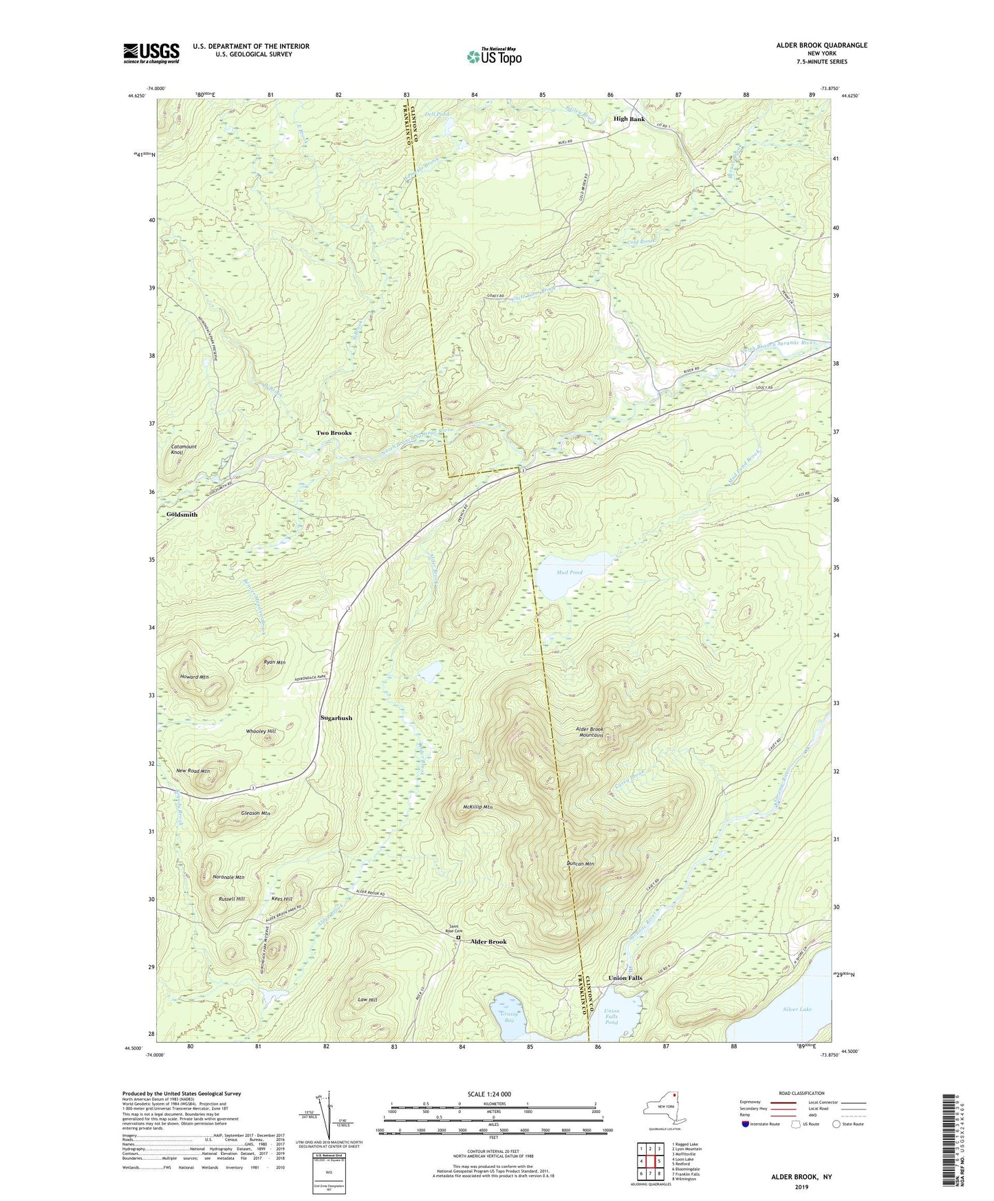
2023 topographic map quadrangle Alder Brook in the state of New York. Scale: 1:24000. Based on the newly updated USGS 7.5' US Topo map series, this map is in the following counties: Franklin, Clinton. The map contains contour data, water features, and other items you are used to seeing on USGS maps, but also has updated roads and other features. This is the next generation of topographic maps. Printed on high-quality waterproof paper with UV fade-resistant inks.
Quads adjacent to this one:
West: Loon Lake
Northwest: Ragged Lake
North: Lyon Mountain
Northeast: Moffitsville
East: Redford
Southeast: Wilmington
South: Franklin Falls
Southwest: Bloomingdale
This map covers the same area as the classic USGS quad with code o44073e8.
Contains the following named places: Alder Brook, Alder Brook Mountains, Bailey Brook, Beaver Meadow Brook, Bernau Brook, Brandy Brook, Casey Brook, Catamount Knoll, Cold Brook, Dell Pond, Duncan Mountain, East Brook, Gleason Mountain, Goldsmith, Grassy Bay, High Banks Farm Landing Area, Howard Mountain, Kees Hill, Law Hill, Little Bear Bay, McKillip Mountain, Mud Pond, Mud Pond Brook, New Road Mountain, Noranale Mountain, Riverview, Russell Hill, Ryan Mountain, Saint Rose Cemetery, Silver Lake, Sugarbush, Two Brooks, Uncle Toms Brook, Union Falls, Wemette Brook, West Brook, Whooley Hill