MyTopo
Rensselaer Falls New York US Topo Map
Couldn't load pickup availability
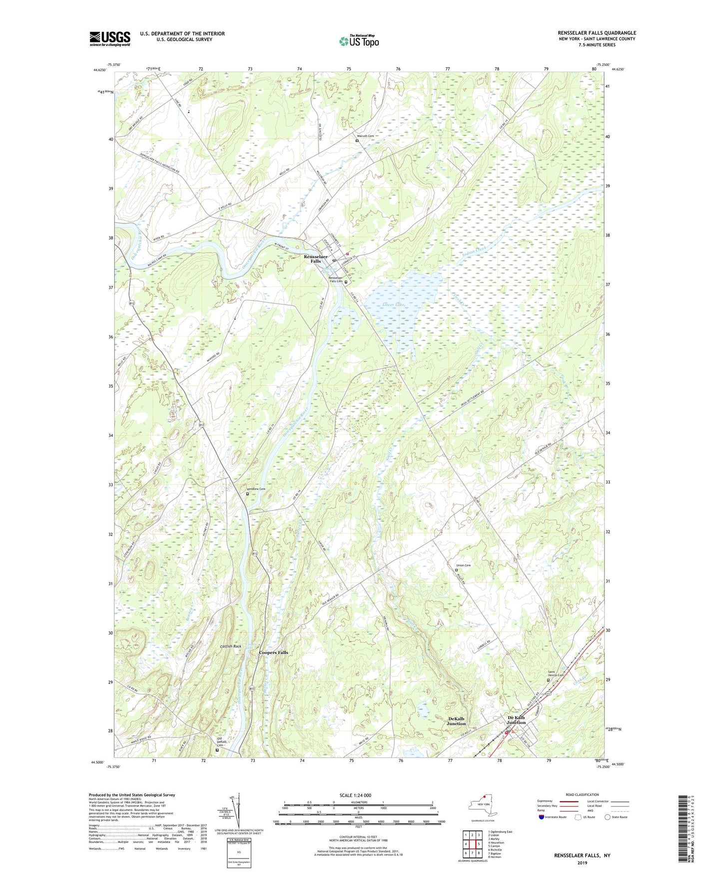
2023 topographic map quadrangle Rensselaer Falls in the state of New York. Scale: 1:24000. Based on the newly updated USGS 7.5' US Topo map series, this map is in the following counties: St. Lawrence. The map contains contour data, water features, and other items you are used to seeing on USGS maps, but also has updated roads and other features. This is the next generation of topographic maps. Printed on high-quality waterproof paper with UV fade-resistant inks.
Quads adjacent to this one:
West: Heuvelton
Northwest: Ogdensburg East
North: Lisbon
Northeast: Morley
East: Canton
Southeast: Hermon
South: Bigelow
Southwest: Richville
This map covers the same area as the classic USGS quad with code o44075e3.
Contains the following named places: Barter Creek, Beaver Creek, Bonney Creek, Canton Free Library Rensselaer Falls Branch, Catfish Rock, Cook Creek, Coopers Falls, De Kalb Junction, De Kalb Junction Post Office, De Kalb Junction Volunteer Fire Department, DeKalb Junction Census Designated Place, Gulf Creek, Indian Creek, Kendrew Cemetery, Kendrew Corners, Lower Lake, Old DeKalb Cemetery, Rensselaer Falls, Rensselaer Falls Cemetery, Rensselaer Falls Post Office, Rensselaer Falls Village Wastewater Treatment Plant, Rensselaer Falls Volunteer Fire Department, Saint Henrys Cemetery, School Number 10, School Number 11, School Number 13, School Number 14, School Number 17, School Number 18, School Number 20, School Number 21, School Number 3, School Number 5, School Number 8, Union Cemetery, Village of Rensselaer Falls, Walruth Cemetery, ZIP Code: 13680