MyTopo
Heuvelton New York US Topo Map
Couldn't load pickup availability
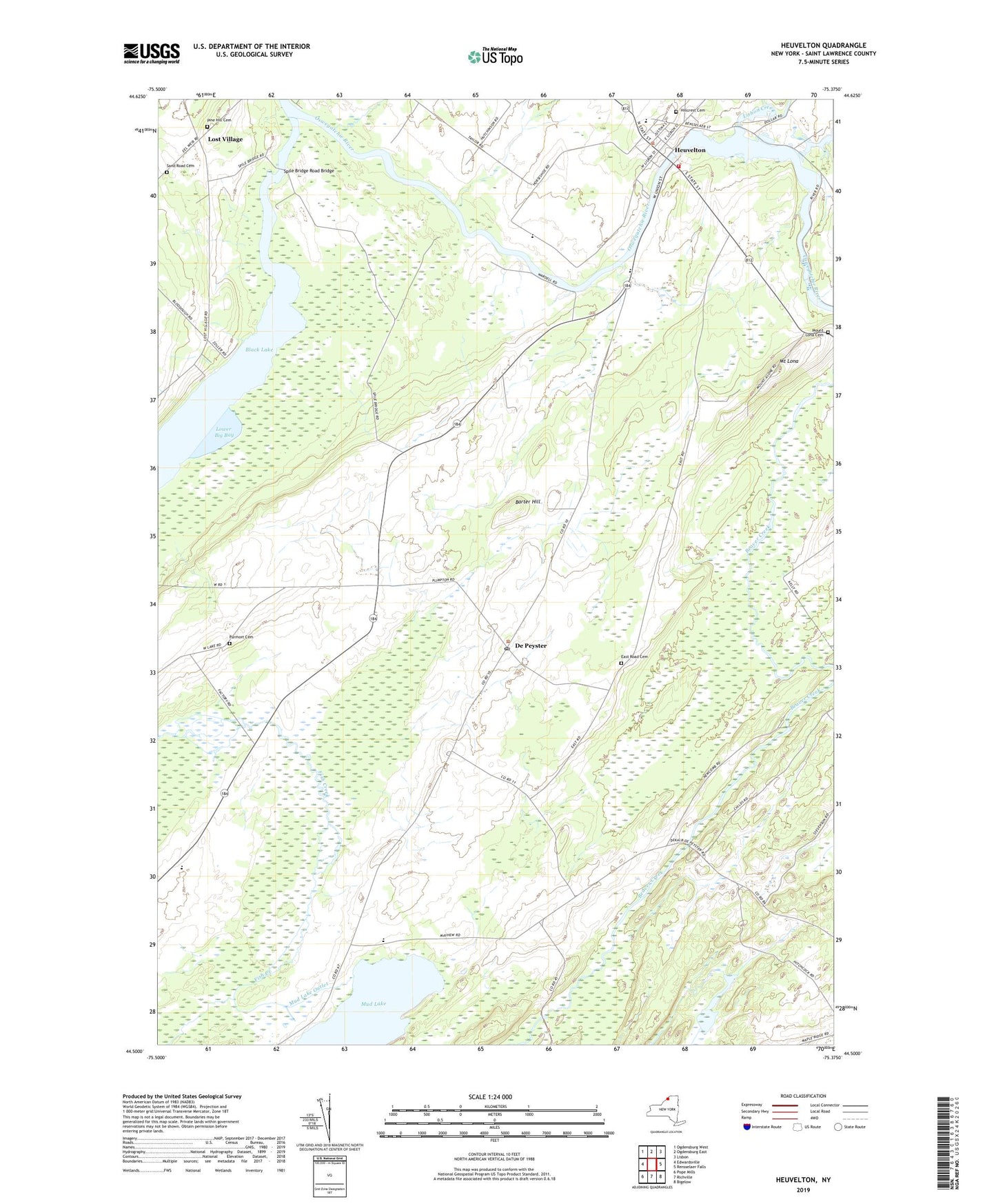
2023 topographic map quadrangle Heuvelton in the state of New York. Scale: 1:24000. Based on the newly updated USGS 7.5' US Topo map series, this map is in the following counties: St. Lawrence. The map contains contour data, water features, and other items you are used to seeing on USGS maps, but also has updated roads and other features. This is the next generation of topographic maps. Printed on high-quality waterproof paper with UV fade-resistant inks.
Quads adjacent to this one:
West: Edwardsville
Northwest: Ogdensburg West
North: Ogdensburg East
Northeast: Lisbon
East: Rensselaer Falls
Southeast: Bigelow
South: Richville
Southwest: Pope Mills
This map covers the same area as the classic USGS quad with code o44075e4.
Contains the following named places: Barter Hill, Bittersweet Farm, Chambers Farms, De Peyster, De Peyster RMPO, East Road Cemetery, Fish Creek School, Heuvelton, Heuvelton Central School, Heuvelton Free Library, Heuvelton Village Water Pollution Control Plant, Heuvelton Volunteer Fire Department, Hillcrest Cemetery, Kokomo Corners, Lisbon Creek, Lost Village, Lower Big Bay, Mount Lona, Mount Lona Cemetery, Mud Lake, Mud Lake Outlet, Pine Hill Cemetery, Purmort Cemetery, Sand Road Cemetery, School Number 1, School Number 15, School Number 2, School Number 3, School Number 4, School Number 5, School Number 6, School Number 9, Spile Bridge Road Bridge, Town of De Peyster, Village of Heuvelton, Wesleyan Church, ZIP Code: 13654