MyTopo
Springwater New York US Topo Map
Couldn't load pickup availability
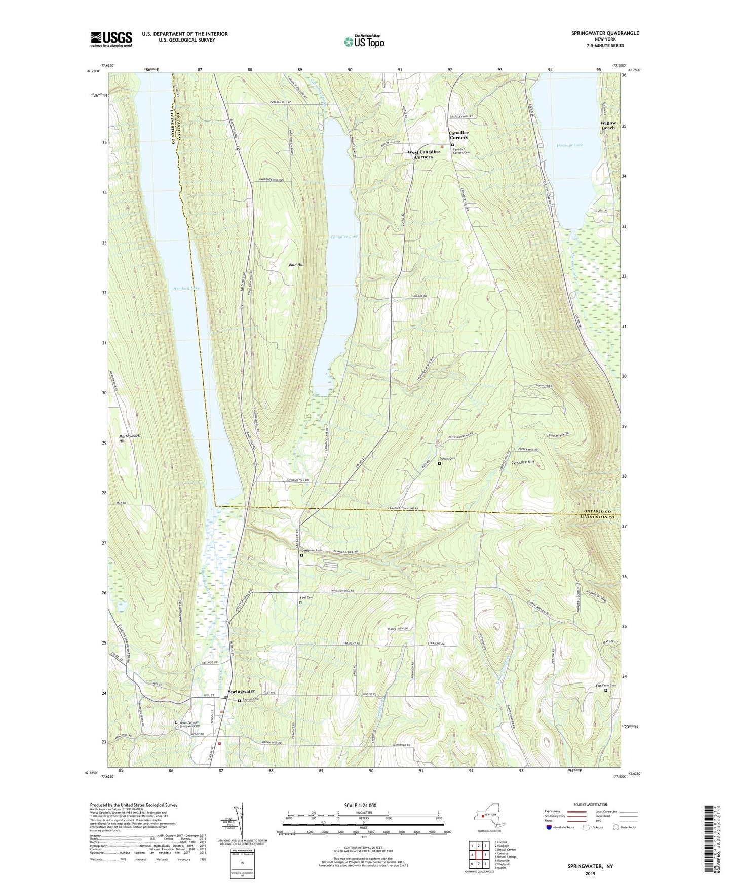
2019 topographic map quadrangle Springwater in the state of New York. Scale: 1:24000. Based on the newly updated USGS 7.5' US Topo map series, this map is in the following counties: Ontario, Livingston. The map contains contour data, water features, and other items you are used to seeing on USGS maps, but also has updated roads and other features. This is the next generation of topographic maps. Printed on high-quality waterproof paper with UV fade-resistant inks.
Quads adjacent to this one:
West: Conesus
Northwest: Livonia
North: Honeoye
Northeast: Bristol Center
East: Bristol Springs
Southeast: Naples
South: Wayland
Southwest: Dansville
Contains the following named places: Bald Hill, Briggs Gully, Canadice Corners, Canadice Corners Cemetery, Canadice Hill, Canadice Lake, Capron Cemetery, Eagle Crest Vineyards, Evergreen Cemetery, Ford Cemetery, Fort Farm Cemetery, Green Gully, Hemlock Lake, Holiday Hill Campground, Honeoye Inlet, Limekiln Creek, Marrowback Hill, Mount Vernon Evergreen Cemetery, Reynolds Gully, School Number 1, School Number 10, School Number 13, School Number 19, School Number 21, School Number 3, School Number 4, School Number 5, School Number 6, Springwater, Springwater Ambulance Volunteer Emergency Services, Springwater Census Designated Place, Springwater Creek, Springwater Fire Department Incorporated, Springwater Post Office, Springwater Town Hall, Springwater Town Wastewater Treatment Facility, Springwater Valley, Tabor Corners, Tibbals Cemetery, Town of Canadice, Town of Springwater, West Canadice Corners, Willow Beach, ZIP Code: 14560