MyTopo
Whitehouse New York US Topo Map
Couldn't load pickup availability
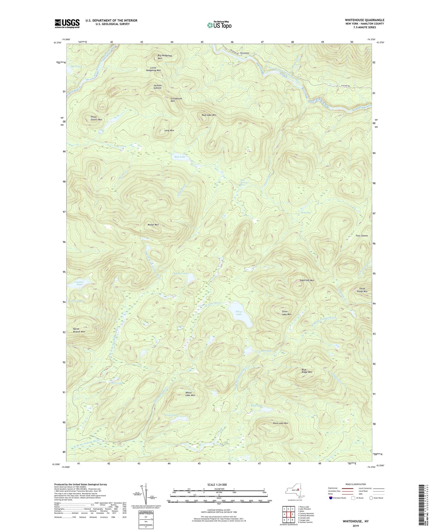
2023 topographic map quadrangle Whitehouse in the state of New York. Scale: 1:24000. Based on the newly updated USGS 7.5' US Topo map series, this map is in the following counties: Hamilton. The map contains contour data, water features, and other items you are used to seeing on USGS maps, but also has updated roads and other features. This is the next generation of topographic maps. Printed on high-quality waterproof paper with UV fade-resistant inks.
Quads adjacent to this one:
West: Tomany Mountain
Northwest: Piseco Lake
North: Lake Pleasant
Northeast: Wells
East: Cathead Mountain
Southeast: Jackson Summit
South: Caroga Lake
Southwest: Canada Lake
Contains the following named places: Big Hedgehog Mountain, Blue Ridge Mountain, Canary Pond, Cole Rooney Flow, Dugway Creek, Goldmine Creek, Grindstone Mountain, Jackson Summit, Little Hedgehog Mountain, Long Mountain, Loomis Pond, Meco Lake, Moose Mountain, Motts Flow, Mud Lake, Mud Lake Lean-to, Mud Lake Mountain, Ninemile Creek, Noisy Brook, North Branch Mountain, Owl Pond, Rock Lake, Rock Lake Mountain, Ross Lake, Silver Lake, Silver Lake Lean-to, Silver Lake Mountain, Silver Lake Outlet, Sugarloaf Mountain, Three Sisters Mountain, White Lake, White Lake Mountain, Whitehouse, Whitman Flow