MyTopo
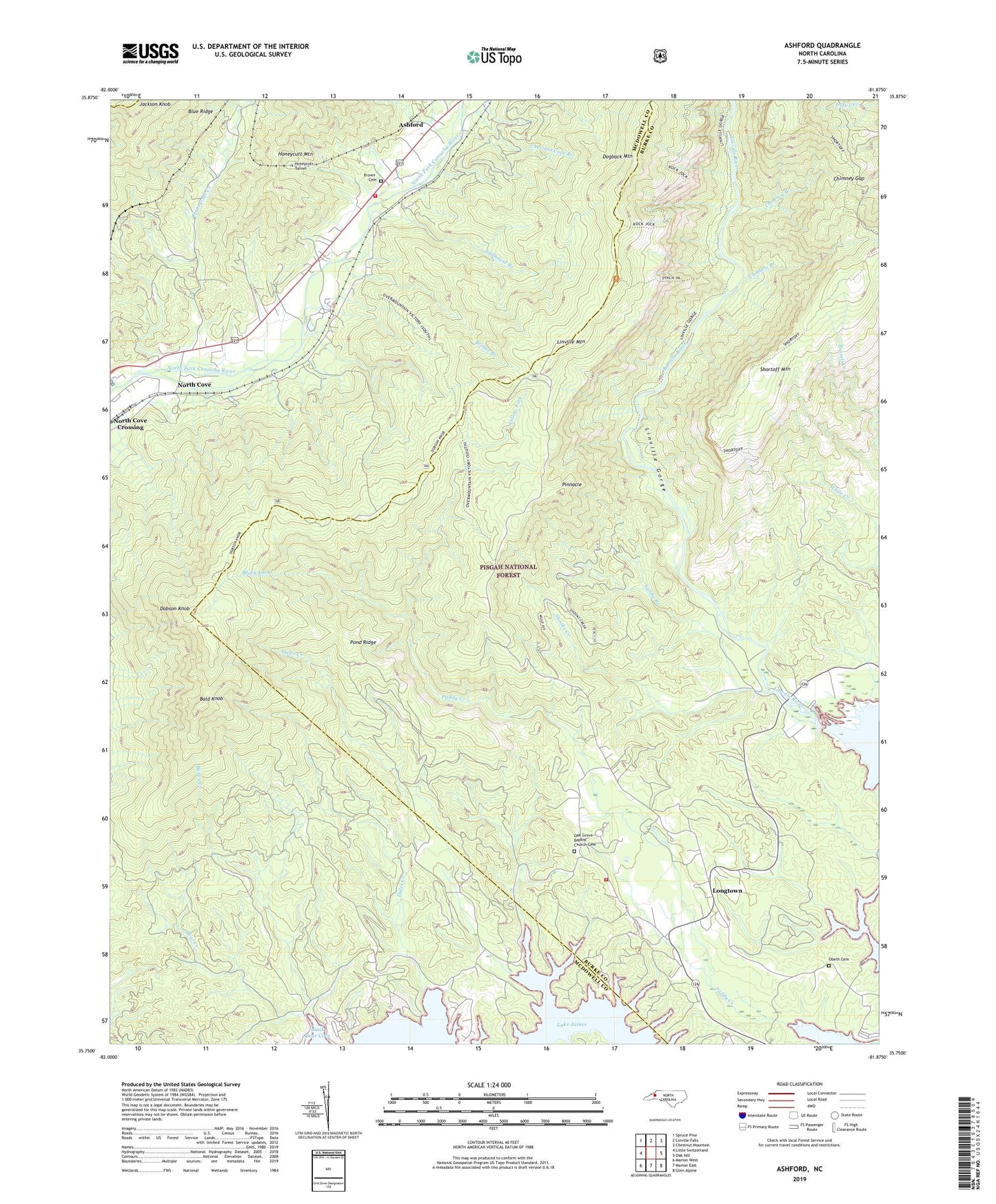
Ashford North Carolina US Topo Map
Couldn't load pickup availability
Also explore the Ashford Forest Service Topo of this same quad for updated USFS data
2022 topographic map quadrangle Ashford in the state of North Carolina. Scale: 1:24000. Based on the newly updated USGS 7.5' US Topo map series, this map is in the following counties: Burke, McDowell, Mitchell. The map contains contour data, water features, and other items you are used to seeing on USGS maps, but also has updated roads and other features. This is the next generation of topographic maps. Printed on high-quality waterproof paper with UV fade-resistant inks.
Quads adjacent to this one:
West: Little Switzerland
Northwest: Spruce Pine
North: Linville Falls
Northeast: Chestnut Mountain
East: Oak Hill
Southeast: Glen Alpine
South: Marion East
Southwest: Marion West
This map covers the same area as the classic USGS quad with code o35081g8.
Contains the following named places: Ashford, Ashford - North Cove Volunteer Fire Department, Bailey Creek, Bald Knob, Bear Creek, Black Fork, Bridge Branch, Brown Cemetery, Cambric Branch, Chestnut Cove Branch, Chimney Branch, Chimney Gap, Dales Creek, Dobson Knob, Dogback Mountain, Dogback Spring Branch, Honeycutt Creek, Honeycutt Tunnel, Linville, Linville Gorge, Longtown, North Cove, North Cove Elementary School, Oak Grove Baptist Church Cemetery, Oak Grove Church, Obeth Cemetery, Pinnacle, Pond Ridge, Rock Hill Church, Sandy Branch, Shooks Creek, Shortoff Mountain, South Mountain Institute, Stillhouse Branch, Township of Linville, Yellow Fork