MyTopo
Chestnut Mountain North Carolina US Topo Map
Couldn't load pickup availability
Also explore the Chestnut Mountain Forest Service Topo of this same quad for updated USFS data
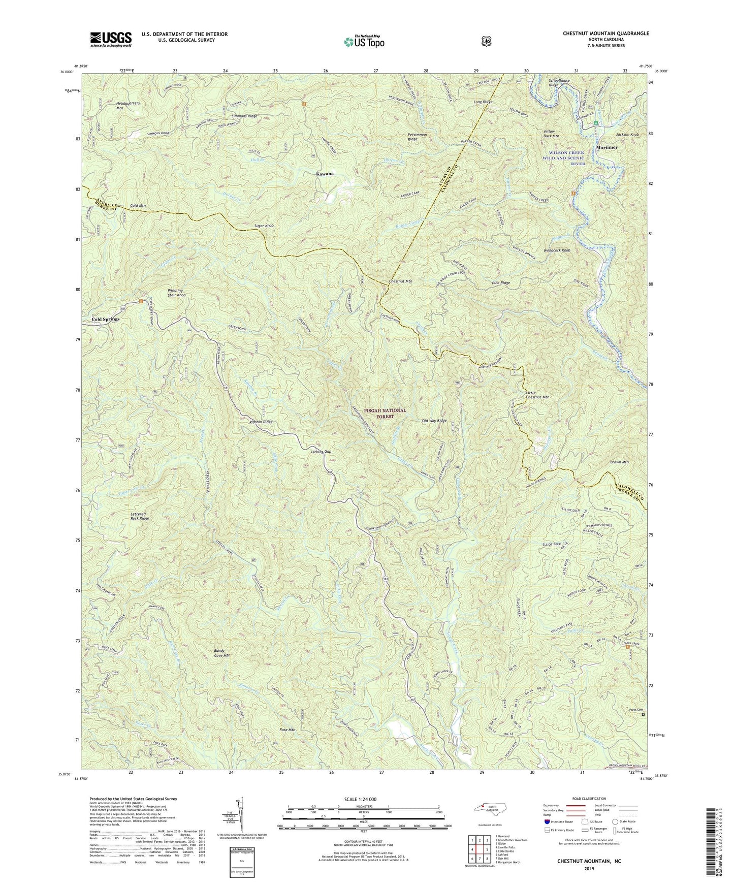
2022 topographic map quadrangle Chestnut Mountain in the state of North Carolina. Scale: 1:24000. Based on the newly updated USGS 7.5' US Topo map series, this map is in the following counties: Burke, Caldwell, Avery. The map contains contour data, water features, and other items you are used to seeing on USGS maps, but also has updated roads and other features. This is the next generation of topographic maps. Printed on high-quality waterproof paper with UV fade-resistant inks.
Quads adjacent to this one:
West: Linville Falls
Northwest: Newland
North: Grandfather Mountain
Northeast: Globe
East: Collettsville
Southeast: Morganton North
South: Oak Hill
Southwest: Ashford
This map covers the same area as the classic USGS quad with code o35081h7.
Contains the following named places: Bandy Cove Mountain, Barkhouse Picnic Area, Brown Mountain, Brown Mountain Overlook Scenic View, Buck Creek, Burnthouse Branch, Chestnut Mountain, Cold Mountain, Cold Springs, Craig Creek, Daniel Boone Wildlife Management Area, Estes Mill Creek, Gingercake Creek, Griffith Branch, Harper Creek, Headquarters Mountain, Horsepen Creek, Hull Branch, Jackson Knob, Kawana, Licklog Gap, Little Chestnut Mountain, Little Fork, Mortimer, Mortimer Recreation Area, Mortimer Work Center, Old Way Ridge, Parks Cemetery, Persimmon Ridge, Phillips Branch, Pine Ridge, Raider Camp Creek, Rich Cove Branch, Ripshin Branch, Ripshin Ridge, Rose Mountain, Simmons Ridge, Sugar Knob, Thorps Creek, Timbered Branch, Township of Wilson Creek, Wilson Creek Wild and Scenic River, Windling Stair Knob, Woodcock Knob, Yellow Buck Mountain