MyTopo
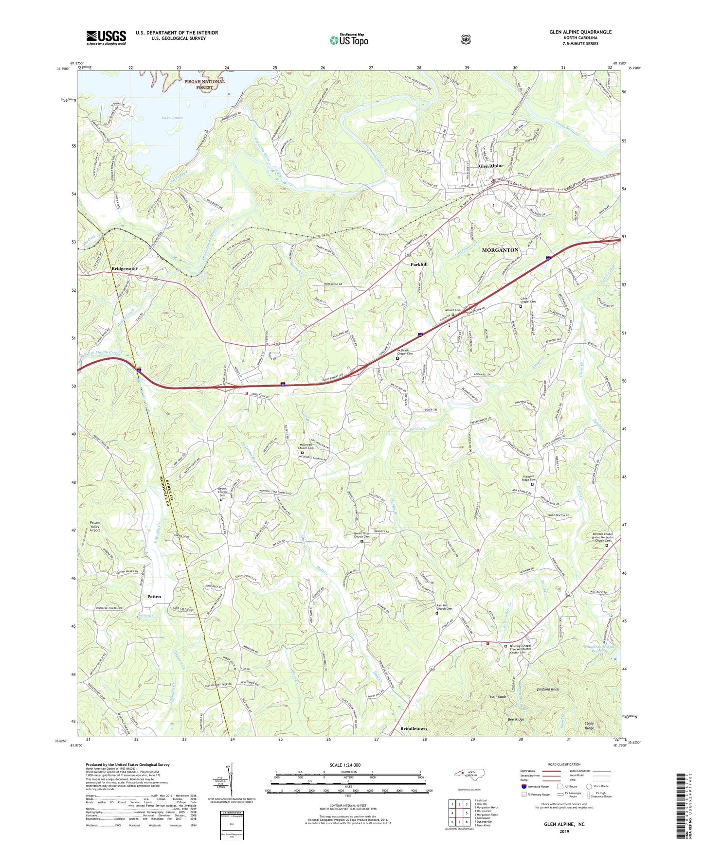
Glen Alpine North Carolina US Topo Map
Couldn't load pickup availability
Also explore the Glen Alpine Forest Service Topo of this same quad for updated USFS data
2022 topographic map quadrangle Glen Alpine in the state of North Carolina. Scale: 1:24000. Based on the newly updated USGS 7.5' US Topo map series, this map is in the following counties: Burke, McDowell. The map contains contour data, water features, and other items you are used to seeing on USGS maps, but also has updated roads and other features. This is the next generation of topographic maps. Printed on high-quality waterproof paper with UV fade-resistant inks.
Quads adjacent to this one:
West: Marion East
Northwest: Ashford
North: Oak Hill
Northeast: Morganton North
East: Morganton South
Southeast: Benn Knob
South: Dysartsville
Southwest: Glenwood
This map covers the same area as the classic USGS quad with code o35081f7.
Contains the following named places: Advent Cemetery, Anderson Branch, Bethel Church, Bethel Church Cemetery, Brendletown Fire and Rescue Protection Association Station 1, Brendletown Fire and Rescue Protection Association Station 2, Bridgewater, Bridgewater Dam, Bridgewater Presbyterian Church, Brindle Mines, Brindletown, Broughton Hospital Dam, Broughton Hospital Reservoir, Burke County Emergency Services Station 3, Chambers Chapel, Chestnut Flat Branch, Clear Creek, Copening Church, Dentons Chapel, Dentons Chapel United Methodist Church Cemetery, Double Branch, Dry Pond School, Duke School, England Knob, First Baptist Church of Glen Alpine, Gibbs Chapel, Gibbs Chapel Cemetery, Glen Alpine, Glen Alpine Elementary and Junior High School, Glen Alpine Post Office, Glen Alpine Rural School, Glen Alpine Volunteer Fire Department, Hall Creek, Hall Knob, Hardaway, Henredon Dam, Henredon Lake, Hoppers Creek, Jack Branch, James Branch, Lake James Dam, Linville Dam, Linville River, Long Branch, Matthews Store, Mc Alpine School, Mc Dowell Church, Mc Elrath Chapel, McDowell Church Cemetery, McElrath Chapel Cemetery, McKees Store, Morganton Junior Academy, Morrison Chapel, Mount Herman Church, Mount Olive Church, Mount Olive Church Cemetery, Mountain View Church, Muddy Creek, North Muddy Creek, Nowling Chapel, Nowlings Chapel Free Will Baptist Church Cemetery, Old Catawba River, Old Paddy Creek, Paddy Creek Dam, Paddys Creek Dam, Parkhill, Patten, Patton Valley Airport, Peoples Church, Pilot Mountain School, Pinedale School, Pinnacle Church, Pleasant Ridge Cemetery, Pleasant Ridge Church, Rain Hill Church, Rain Hill Church Cemetery, Reedy Creek, Rollins, Shadrick Creek, Shoal Creek, Snow Hill Church, South Muddy Creek, Sutterwhite Creek, Town of Glen Alpine, Township of Silver Creek, Wesleyan Methodist Church, West End Volunteer Fire Department, ZIP Code: 28628