MyTopo
Ayersville North Carolina US Topo Map
Couldn't load pickup availability
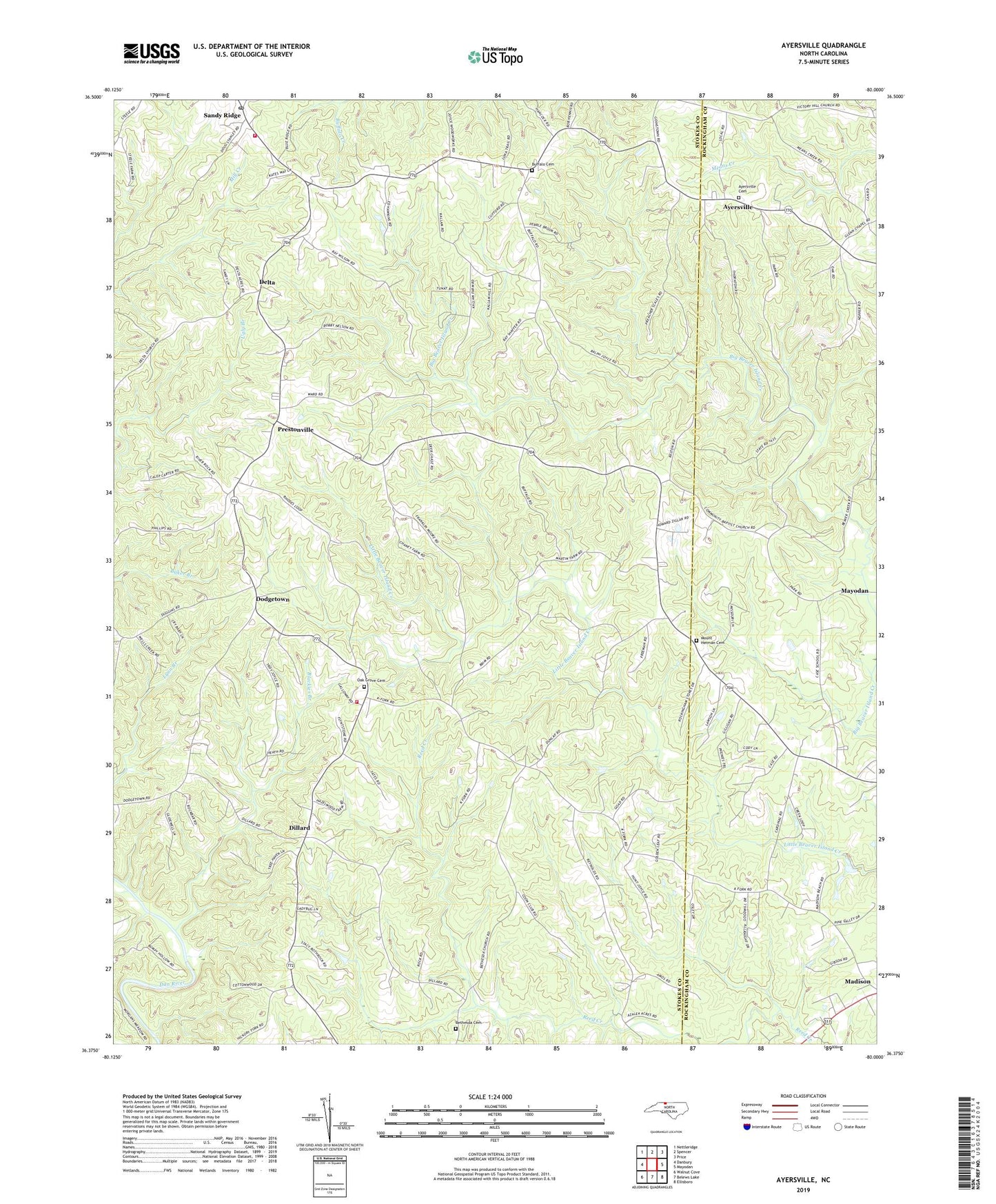
2019 topographic map quadrangle Ayersville in the state of North Carolina. Scale: 1:24000. Based on the newly updated USGS 7.5' US Topo map series, this map is in the following counties: Stokes, Rockingham. The map contains contour data, water features, and other items you are used to seeing on USGS maps, but also has updated roads and other features. This is the next generation of topographic maps. Printed on high-quality waterproof paper with UV fade-resistant inks.
Quads adjacent to this one:
West: Danbury
Northwest: Nettleridge
North: Spencer
Northeast: Price
East: Mayodan
Southeast: Ellisboro
South: Belews Lake
Southwest: Walnut Cove
Contains the following named places: Ayersville, Ayersville Baptist Church, Ayersville Baptist Church Cemetery, Bethesda Cemetery, Bethesda United Methodist Church, Blackies Branch, Buffalo, Buffalo Cemetery, Buffalo Primitive Baptist Church, Byrd Memorial Church, Case School, Community Baptist Church, Delta, Delta United Methodist Church, Dillard, Dodgetown, Good Will School, Goodwill Baptist Church, Hemlock Golf Course Site, Martin School, Mount Herman Cemetery, Mount Herman United Methodist Church, Northeast Stokes Volunteer Fire and Rescue, Oak Grove Cemetery, Oak Grove Missionary Baptist Church, Prestonville, Sandy Ridge, Sandy Ridge Post Office, Stokes - Rockingham Volunteer Fire and Rescue Station 2, Township of Beaver Island, Township of Snow Creek, Victor Hill Pentecostal Holiness Church, Wilson Primitive Baptist Church