MyTopo
Calahaln North Carolina US Topo Map
Couldn't load pickup availability
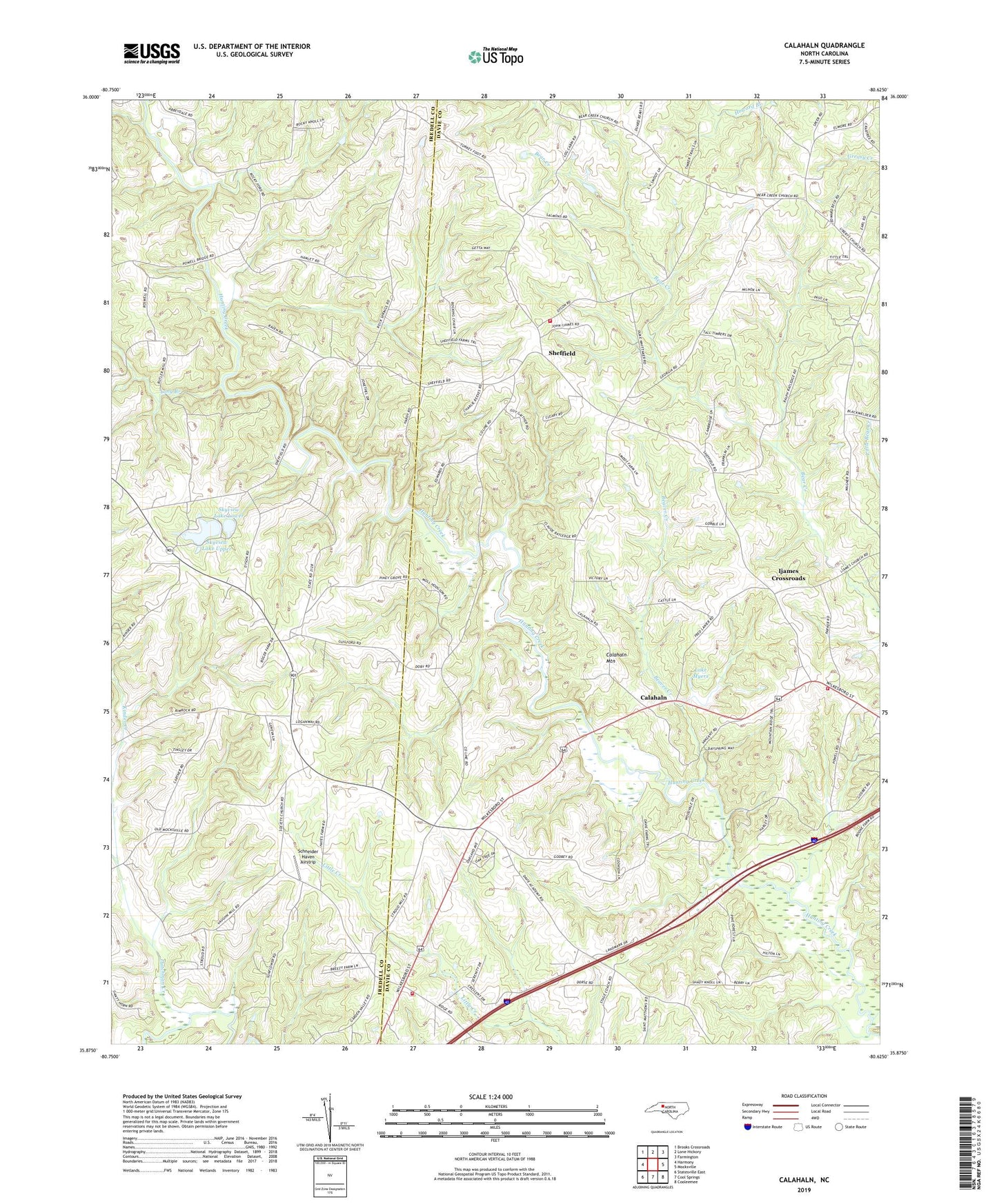
2022 topographic map quadrangle Calahaln in the state of North Carolina. Scale: 1:24000. Based on the newly updated USGS 7.5' US Topo map series, this map is in the following counties: Davie, Iredell. The map contains contour data, water features, and other items you are used to seeing on USGS maps, but also has updated roads and other features. This is the next generation of topographic maps. Printed on high-quality waterproof paper with UV fade-resistant inks.
Quads adjacent to this one:
West: Harmony
Northwest: Brooks Crossroads
North: Lone Hickory
Northeast: Farmington
East: Mocksville
Southeast: Cooleemee
South: Cool Springs
Southwest: Statesville East
This map covers the same area as the classic USGS quad with code o35080h6.
Contains the following named places: Bear Creek Church, Beaver Creek, Bones Store, Calahaln, Calahaln Mountain, Clarksbury Church, Clement Grove Church of God, County Line Fire Station 18, County Line Post Office, Davie Center Volunteer Fire Department Station 13, Dutchman Creek, Gather, Houstonville, Ijames Crossroads, Ijames Crossroads Baptist, Kinder Creek, Lake Myers, Lake Myers Family Campground, Liberty Church, Long Branch, New Union Church, Oakland Heights, Piney Grove Church, Pleasant View Church, Rock Spring Church, Saint Matthews Church, Salem Church, Schneider Haven Airstrip, Sheffield, Sheffield - Calahaln Fire Station 16, Skyview Lake, Skyview Lake Dam Upper, Skyview Lake Lower, Skyview Lake Lower Dam, Skyview Lake Upper, Smith Grove Quarry, Society Church, Township of Calahaln, V Point, Zion Chapel