MyTopo
Harmony North Carolina US Topo Map
Couldn't load pickup availability
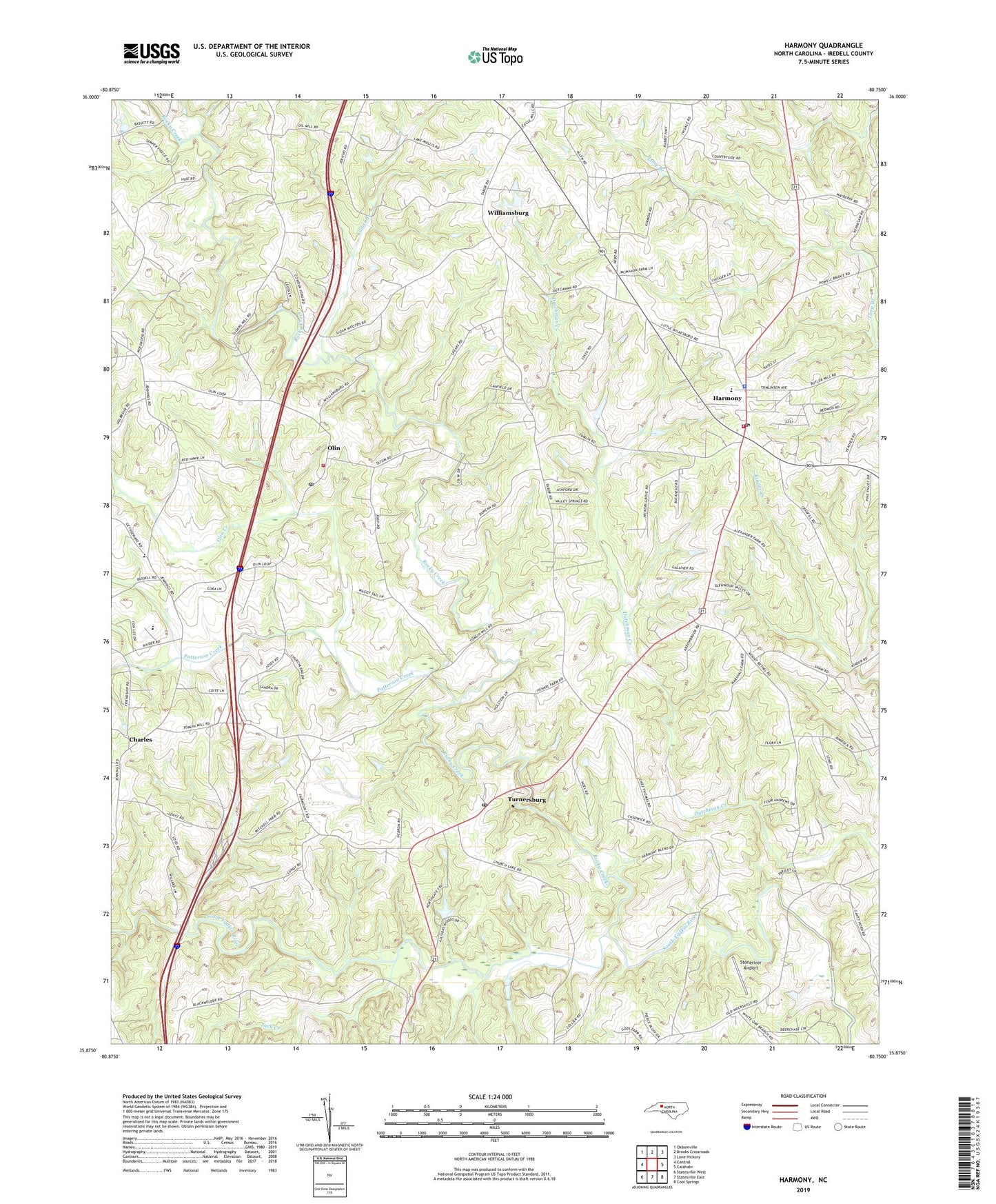
2022 topographic map quadrangle Harmony in the state of North Carolina. Scale: 1:24000. Based on the newly updated USGS 7.5' US Topo map series, this map is in the following counties: Iredell. The map contains contour data, water features, and other items you are used to seeing on USGS maps, but also has updated roads and other features. This is the next generation of topographic maps. Printed on high-quality waterproof paper with UV fade-resistant inks.
Quads adjacent to this one:
West: Central
Northwest: Osbornville
North: Brooks Crossroads
Northeast: Lone Hickory
East: Calahaln
Southeast: Cool Springs
South: Statesville East
Southwest: Statesville West
This map covers the same area as the classic USGS quad with code o35080h7.
Contains the following named places: Allison Lake, Allison Lake Dam, Camel Branch, Camp Alwood, Charles, Fairmount Church, Harmony, Harmony Post Office, Harmony School, Harmony Volunteer Fire Department Station 1, Harmony Volunteer Fire Department Station 2, Hebron Church, Hollysprings Church, Iredell County Sheriff's Department, Jack Creek, Macedonia Church, Moss Chapel, Mount Bethel Church, Mount Nebo Church, Mount Sinai Church, Mount Vernon Church, New Hope Church, North Iredell High School, North Iredell Rescue Squad, Olin, Olin Creek, Olin Post Office, Patterson Creek, Rocky Creek, Rocky Creek Church, Siloan Church, Stoneriver Airport, Tabor Church, Town of Harmony, Township of Olin, Township of Turnersburg, Turnersburg, Turnersburg Post Office, Williamsburg, ZIP Codes: 28634, 28660