MyTopo
Mocksville North Carolina US Topo Map
Couldn't load pickup availability
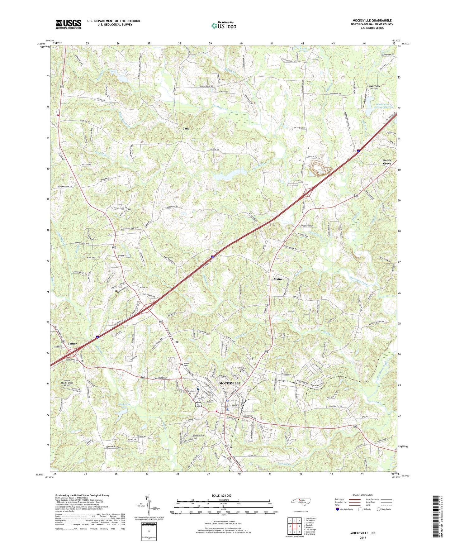
2022 topographic map quadrangle Mocksville in the state of North Carolina. Scale: 1:24000. Based on the newly updated USGS 7.5' US Topo map series, this map is in the following counties: Davie. The map contains contour data, water features, and other items you are used to seeing on USGS maps, but also has updated roads and other features. This is the next generation of topographic maps. Printed on high-quality waterproof paper with UV fade-resistant inks.
Quads adjacent to this one:
West: Calahaln
Northwest: Lone Hickory
North: Farmington
Northeast: Clemmons
East: Advance
Southeast: Churchland
South: Cooleemee
Southwest: Cool Springs
This map covers the same area as the classic USGS quad with code o35080h5.
Contains the following named places: Autumn Care Nursing Home, Becks Spring Branch, Bethel Church, Blaise Church, Blue Branch, Booetown, Boyd's Hawks Creek Airport, Brook Center Masonic Picnic Grounds, Bryant Branch, Cana, Cedar Creek, Center, Center Methodist, Chestnut Grove Church, Cub Creek, Davie County, Davie County Emergency Medical Services Station 1, Davie County Hospital, Davie County Rescue Squad Station 4, Davie County Sheriff's Office, Davie Youth Park, Dutchman Creek W/S Number Six, Dutchman Creek W/S Number Ten, Dutchman Creek W/S Structure Number Six Dam, Dutchman Post Office, Eaton Church, Elisha Creek, Farmland Acres, Frost Mill Creek, Greasy Creek, Hodman, Hodmans Post Office, Joppa Cemetery, Leonard Creek, Little Bear Creek, Maine, Mainville Church, Martins Lake, Martins Lake Dam, Masonic Lodge, Mocksville, Mocksville Elementary School, Mocksville Fire Station 22, Mocksville Industrial Park, Mocksville Lake, Mocksville Lake Dam, Mocksville Middle School, Mocksville Pentecostal Holiness, Mocksville Police Department, Mocksville Post Office, Nelson Creek, Noland Creek, North Davie Junior High School, Oak Grove Church, Palmetto Church, Rich Park, Rose Cemetery, Saint Francis Church, Saint Johns American Methodist Episcopal Zion Church, Smith Grove, Smith Grove Methodist, South Davie Junior High School, Squire Boone Plaza, Stanleys Store, Sugar Creek, Sugar Valley Airport, Town of Mocksville, Township of Mocksville, Union Chapel, WDSL-AM (Mocksville), William R Davie Elementary School, William R Davie Volunteer Fire Department, Willow Oaks Shopping Center, ZIP Code: 27028