MyTopo
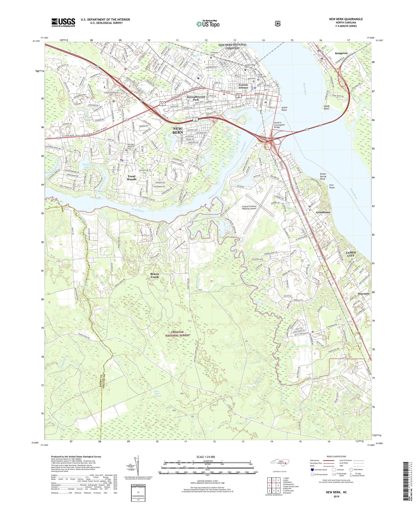
New Bern North Carolina US Topo Map
Couldn't load pickup availability
Also explore the New Bern Forest Service Topo of this same quad for updated USFS data
2022 topographic map quadrangle New Bern in the state of North Carolina. Scale: 1:24000. Based on the newly updated USGS 7.5' US Topo map series, this map is in the following counties: Craven, Jones. The map contains contour data, water features, and other items you are used to seeing on USGS maps, but also has updated roads and other features. This is the next generation of topographic maps. Printed on high-quality waterproof paper with UV fade-resistant inks.
Quads adjacent to this one:
West: Pollocksville
Northwest: Jasper
North: Askin
Northeast: Reelsboro
East: Upper Broad Creek
Southeast: Havelock
South: Catfish Lake
Southwest: Maysville
This map covers the same area as the classic USGS quad with code o35077a1.
Contains the following named places: Alfred A Cunningham Bridge, Alterra Sterling House of New Bern, Bern Cemetery, Bernwood Mobile Home Park, Black Branch, Bowling Heights, Brice Creek, Brice Creek Pocoson, Brice Creek Recreation Site, Brices Creek, Brices Creek Census Designated Place, Bridge Creek, Bridgeton, Bridgeton Emergence Medical Services, Bridgeton Post Office, Brinson Memorial School, Broad Street Christian Church, Carebridge Assisted Living Community of New Bern, Carolina East Medical Center, Cedar Grove Cemetery, Centenary Methodist Church, Christ Episcopal Church, Circle L Mobile Home Park, City of New Bern, Coastal Carolina Regional Airport, Colony Estates, Country Club Hills, Country Club Park, Craven - Pamlico - Carteret Regional Library, Craven County, Craven Terrace, Creekwood, Cypress Lake, Cypress Shores, DeGraffenried Park, Downtown New Bern Post Office, Duck Creek, Edgewood, Evergreen Cemetery, First Church of Christ Scientist, First Presbyterian Church, Fort Armory, Fort Chase, Fort Dutton, Fort Gaston, Fort Point, Fort Rowan, Fort Spinola, Fort Totten, Fort Totten Park, Fox Chase Village Mobile Home Park, Fox Hollow, Georges Branch, Good Shepherd Hospital, Granthams, Green Spring Point, Greenwood, Greenwood Cemetery, Haywood Farms, Holly Hills, Hoods Creek, James City, James City Census Designated Place, Kafer Park, Lane Branch, Lawson Creek, Lawson Creek Park, Lees Branch, Lilliput Landing, Manning Park, NC WRC Work Center, Neuse Forest Post Office, New Bern, New Bern City Hall, New Bern Country Club, New Bern Fire and Rescue Department - Headquarters Station, New Bern Fire Department - Station 2, New Bern Fire Rescue Department Station 4, New Bern Memorial Cemetery, New Bern National Cemetery, New Bern Police Department, New Bern Post Office, North Carolina State Highway Patrol Troop A District 6, Number 7 Township Emergency Medical Services, Number 7 Township Fire and Rescue Department - Station 1, Number 7 Township Volunteer Fire and Rescue Department - Station 2 - Station, Oakdale, Old Town Harbor, Old Towne Lake, Pamlico Rescue Squad, Police Neighborhood Resource, Quail Ridge, Reedy Branch, Saint Marys Free Will Baptist Church, Saint Pauls Catholic Church, Saint Pauls Church, Saint Pauls School, Saint Phillip Church of Christ, Sandy Point, Scottish Rite Temple, Scotts Creek, Snug Harbor, Southgate, Sudan Temple, Tabernacle Baptist Church, Thurman, Timothy Chapel, Town of Trent Woods, Township 7, Township 8, Trent Marsh, Trent River, Trent Shores, Trent Woods, Trent Woods Police Department, Tri - Community Volunteer Fire District, Twin Rivers Mall, Two Rivers Healthcare Center Neuse Campus, Two Rivers Healthcare Center Trent Campus, Union Point, Union Point Park, US Marshal, WBIC-AM (New Bern), West of New Bern Volunteer Fire Department Station 1, WHIT Tower, Wilson Creek, Wilson Creek Heights, WJQI-AM (New Bern), WJVB Tower, WTEB-FM (New Bern), ZIP Code: 28519


