MyTopo
Charity North Carolina US Topo Map
Couldn't load pickup availability
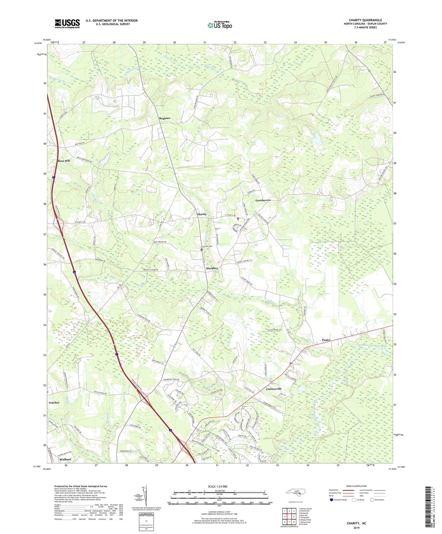
2022 topographic map quadrangle Charity in the state of North Carolina. Scale: 1:24000. Based on the newly updated USGS 7.5' US Topo map series, this map is in the following counties: Duplin. The map contains contour data, water features, and other items you are used to seeing on USGS maps, but also has updated roads and other features. This is the next generation of topographic maps. Printed on high-quality waterproof paper with UV fade-resistant inks.
Quads adjacent to this one:
West: Rose Hill
Northwest: Warsaw South
North: Kenansville
Northeast: Beulaville
East: Chinquapin
Southeast: Pin Hook
South: Wallace East
Southwest: Wallace West
This map covers the same area as the classic USGS quad with code o34077g8.
Contains the following named places: Beaverdam Branch, Bethel Church, Cartersville, Charity, Charity Junior High School, Charity Methodist Church, Clay Hill Cemetery, Cooks Branch, Elder Chapel, Elder Creek, Golden Care Nursing Home, Greenevers, Greenevers Police Department, Greenevers Volunteer Fire Department, Guiding Star Church, Hancheys Store, Island Creek, Island Creek Church, Jones Chapel, Murphey, New Christian Chapel, Northeast Church, Northeast Volunteer Fire Department, Oakie Branch, Pasley, Reedy Branch, Register, Teacheys Store, Town 'N' Country Shopping Center, Town of Greenevers, Township of Island Creek, Wallace Rose Hill High School, WLSE-AM (Wallace), WZKB-FM (Wallace), Xenia Post Office