MyTopo
Churchland North Carolina US Topo Map
Couldn't load pickup availability
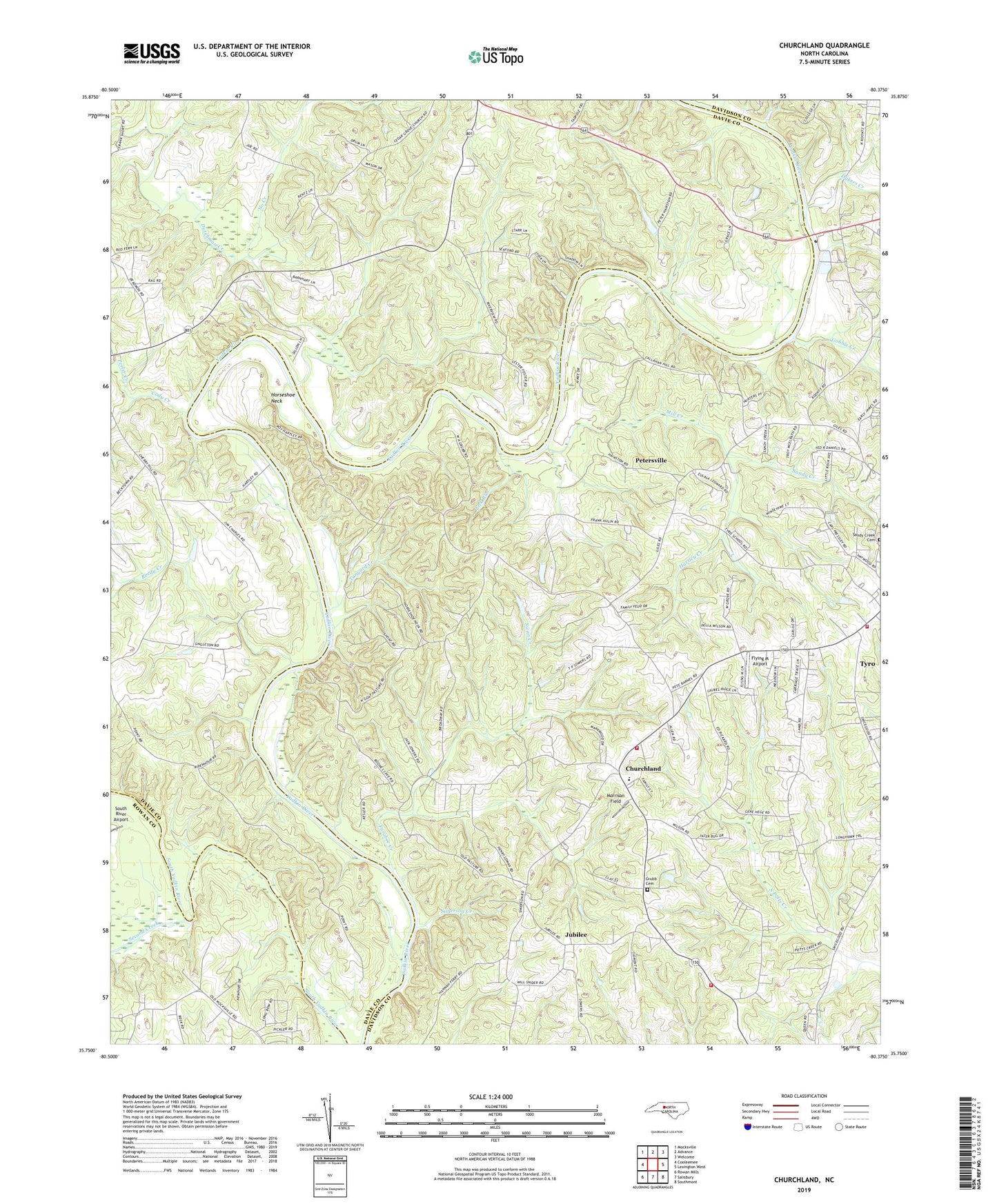
2022 topographic map quadrangle Churchland in the state of North Carolina. Scale: 1:24000. Based on the newly updated USGS 7.5' US Topo map series, this map is in the following counties: Davidson, Davie, Rowan. The map contains contour data, water features, and other items you are used to seeing on USGS maps, but also has updated roads and other features. This is the next generation of topographic maps. Printed on high-quality waterproof paper with UV fade-resistant inks.
Quads adjacent to this one:
West: Cooleemee
Northwest: Mocksville
North: Advance
Northeast: Welcome
East: Lexington West
Southeast: Southmont
South: Salisbury
Southwest: Rowan Mills
This map covers the same area as the classic USGS quad with code o35080g4.
Contains the following named places: Boons Ford, Buncomb Baptist Church, Cedar Grove Church, Churchland, Churchland Elementary School, Churchland Volunteer Fire Department Station 31, Churchland Volunteer Fire Department Station 32, Clicks Ferry, Clinton, Cody Creek, Crossroads Church, Daniel Boone State Park, Davidson County Emergency Medical Services Base 5, Davidson County Extended Day School, Dutchman Creek, Dutchmans Creek Church, Dykers Creek, Faith Baptist Tabernacle, Farabee Creek, Flying M Airport, Forest Lake, Forest Lake Dam, Frost Creek, Gobble Creek, Grace Baptist Church, Grace Baptist School, Grubb Cemetery, Hairstons Ferry site, Hannas Ferry, Hartley Creek, Hartleys Ferry site, Horseshoe Neck, Ives Ferry, Jubilee, Jubilee Acres, Lick Run, Martins Store, Mill Creek, Morrison Field, No Creek, Oak Grove Primitive Baptist Church, Oaks Ferry site, Peeler Creek, Petersville, Petersville School, Plantation Lake, Plantation Lake Dam, Reedy Creek, Saint Johns School, Saint Lukes Lutheran Church, Sandy Creek, Sandy Creek Cemetery, Second Creek, Simerson Creek, Sowers Ferry site, Staley Lake, Staley Lake Dam, Swan Creek, Tanyard Creek, Township of Boone, Trumps Ferry, Tyro Census Designated Place, Tyro Rural Fire Department Station 67, Tyro United Methodist Church, Union Chapel School, Yadkin College Baptist Church, Yadkin Star Baptist Church, ZIP Code: 27299