MyTopo
Welcome North Carolina US Topo Map
Couldn't load pickup availability
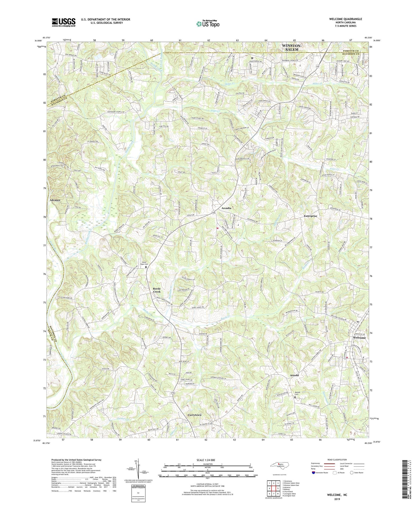
2022 topographic map quadrangle Welcome in the state of North Carolina. Scale: 1:24000. Based on the newly updated USGS 7.5' US Topo map series, this map is in the following counties: Davidson, Forsyth, Davie. The map contains contour data, water features, and other items you are used to seeing on USGS maps, but also has updated roads and other features. This is the next generation of topographic maps. Printed on high-quality waterproof paper with UV fade-resistant inks.
Quads adjacent to this one:
West: Advance
Northwest: Clemmons
North: Winston-Salem West
Northeast: Winston-Salem East
East: Midway
Southeast: Lexington East
South: Lexington West
Southwest: Churchland
This map covers the same area as the classic USGS quad with code o35080h3.
Contains the following named places: Arcadia, Arcadia - Reedy Creek - Hampton Fire and Rescue, Arcadia School, Arcadia United Methodist Church, Arnold, Bethel Baptist Church, Beulah Cemetery, Beulah United Church of Christ, Centenary Methodist Church, Center Methodist Church, Creadmore, Currytown, Enterprise, Eureka Mills, Fairview Tabernacle, Friedburg, Friedburg Moravian Church, Friedburg Moravian God's Acre Cemetery, Friendship Methodist Church, Fryes Creek, Good Hope Cemetery, Good Hope Methodist Church, Goodwill Baptist Church, Grace Chapel, Huffmans Creek, Katys Creek, Katys Spring, Maple Grove Church, Miller Creek, Mount Olivet Methodist Church, Muddy Creek, Muddy Creek Church, Munroe, Nestleway Acres, Northwest Elementary School, Old Mill, Reedy Creek, Reedy Creek Baptist Church, Reedy Creek Church, Reedy Creek School, South Fork Muddy Creek, Township of Arcadia, Township of Hampton, Township of Reedy Creek, Union Grove Church, Walks, Welcome, Welcome Census Designated Place, Welcome Church of God, Welcome Elementary School, Welcome Fire and Rescue Station 73, Welcome Post Office