MyTopo
Southmont North Carolina US Topo Map
Couldn't load pickup availability
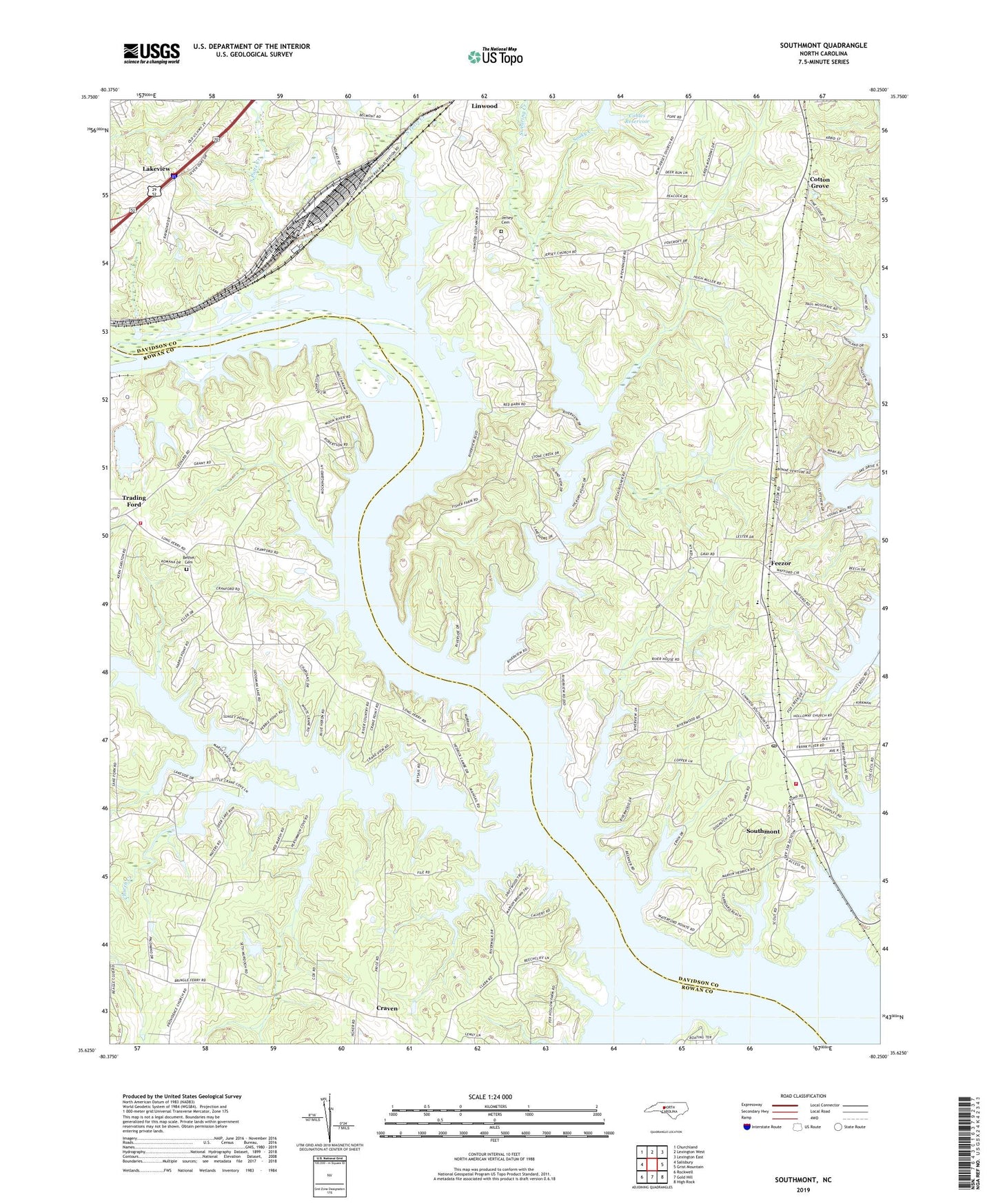
2022 topographic map quadrangle Southmont in the state of North Carolina. Scale: 1:24000. Based on the newly updated USGS 7.5' US Topo map series, this map is in the following counties: Davidson, Rowan. The map contains contour data, water features, and other items you are used to seeing on USGS maps, but also has updated roads and other features. This is the next generation of topographic maps. Printed on high-quality waterproof paper with UV fade-resistant inks.
Quads adjacent to this one:
West: Salisbury
Northwest: Churchland
North: Lexington West
Northeast: Lexington East
East: Grist Mountain
Southeast: High Rock
South: Gold Hill
Southwest: Rockwell
This map covers the same area as the classic USGS quad with code o35080f3.
Contains the following named places: Abbotts Creek, Bethel Cemetery, Buck Ash Pond, Buck Ash Pond Dam, Camp Sapona, Church Creek, Clodfelter Lake, Clodfelter Lake Dam, Cobles Reservoir, Cobles Reservoir Dam, Cotton Grove, Cotton Grove United Methodist Church, Cowans Ferry, Crane Creek, Craven, Dan Nicholas Lake, Dan Nicholas Lake Dam, Dan Nicholas Park, Feezor, Foxcroff, Greers Chapel United Methodist Church, Hicks Ferry, Jersey, Jersey Baptist Church, Jersey Cemetery, Lakeview, Macedonia United Methodist Church, Millers Ferry Fire Department, Mountain View Estates, New Jersey African Methodist Episcopal Zion Church, North Potts Creek, Providence Church, Ravenwood, Rising Star Church, Second Creek, Sharp Church, Smith Grove Church, Sooky Creek, South Potts Creek, Southmont, Southmont Census Designated Place, Southmont Elementary School, Southmont First Baptist Church, Southmont Post Office, Southmont Volunteer Fire Department Station 56, Swearing Creek, Township of Cotton Grove, Township of Providence, Trading Ford, Trading Ford Church, Watership Downs, Yadkin Church, Zion Church