MyTopo
Cooleemee North Carolina US Topo Map
Couldn't load pickup availability
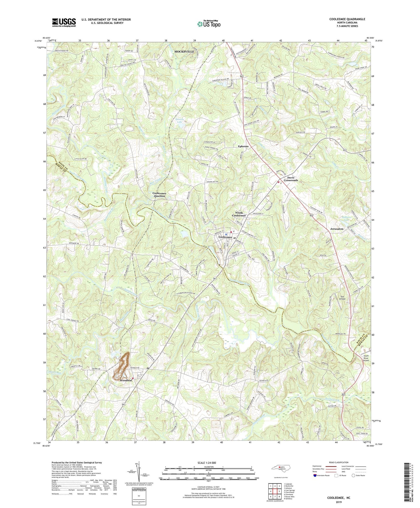
2019 topographic map quadrangle Cooleemee in the state of North Carolina. Scale: 1:24000. Based on the newly updated USGS 7.5' US Topo map series, this map is in the following counties: Davie, Rowan. The map contains contour data, water features, and other items you are used to seeing on USGS maps, but also has updated roads and other features. This is the next generation of topographic maps. Printed on high-quality waterproof paper with UV fade-resistant inks.
Quads adjacent to this one:
West: Cool Springs
Northwest: Calahaln
North: Mocksville
Northeast: Advance
East: Churchland
Southeast: Salisbury
South: Rowan Mills
Southwest: Cleveland
Contains the following named places: Augusta Post Office, Baxter Creek, Bear Creek, Beaverdam Branch, Boxwood Church, Burlington Mills Lake, Calvary Baptist, Cherryhill Church, Concord Church, Cooleeme Police Department, Cooleemee, Cooleemee Dam, Cooleemee Elementary School, Cooleemee Junction, Cooleemee Post Office, Cooleemee Volunteer Fire Department, Daniels Lake, Daniels Lake Dam, Davie County Emergency Medical Services Station 3, Davie County High School, Davie Crossroads, Ephesus, Erwins Temple, Fairfield Baptist, Fourth Creek, Foxwood Golf Course, Frohock Mill site, Hardison Church, Hoffners Lake, Hoffners Lake Dam, Holy Cross Lutheran, Hunting Creek, Jericho Church, Jerusalem, Jerusalem Baptist, Jerusalem Post Office, Jerusalem Township Volunteer Fire Department, Liberty Church, Mount Vernon Church, North Cooleemee, Saint Andrews Church, South River Airport, Tara Airbase, Tennyson Post Office, Third Creek, Town of Cooleemee, Township of Jerusalem, Township of Unity, Turrentine Church, University Church, Woodleaf, Woodleaf Elementary School, Woodleaf Post Office, Woodleaf Quarry, Woodleaf Volunteer Fire Department, ZIP Codes: 27014, 27054