MyTopo
Newton Grove South North Carolina US Topo Map
Couldn't load pickup availability
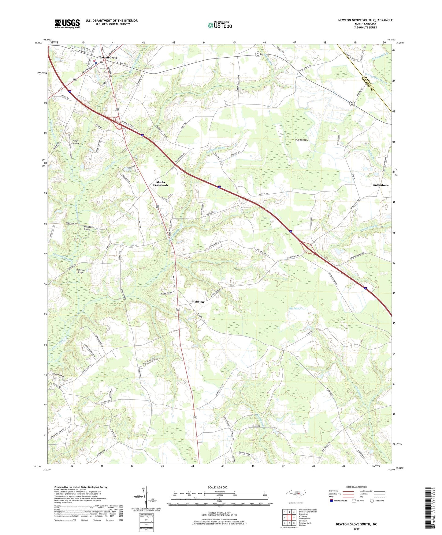
2022 topographic map quadrangle Newton Grove South in the state of North Carolina. Scale: 1:24000. Based on the newly updated USGS 7.5' US Topo map series, this map is in the following counties: Sampson, Wayne. The map contains contour data, water features, and other items you are used to seeing on USGS maps, but also has updated roads and other features. This is the next generation of topographic maps. Printed on high-quality waterproof paper with UV fade-resistant inks.
Quads adjacent to this one:
West: Timothy
Northwest: Peacocks Crossroads
North: Newton Grove North
Northeast: Grantham
East: Dobbersville
Southeast: Faison
South: Clinton North
Southwest: Bearskin
This map covers the same area as the classic USGS quad with code o35078b3.
Contains the following named places: Barksdale Bridge, Beaverdam Church, Beaverdam Swamp, Brewers Store, Bull Pocosin, Carr Memorial Church, Cedar Point Church, Craddock Swamp, Dameron Bridge, Darden Church, Elmore School, Goshen Church, Hobbton, Hobbton Elementary School, Hobbton High School, Kill Swamp, Marys Chapel, Monks Crossroads, Newton Grove, Newton Grove Church, Newton Grove Police Department, Newton Grove Post Office, Newton Grove Rescue Squad, Newton Grove Volunteer Fire Department, Oakland School, Pleasant Union Church, Ruby's Landing, Saint Matthew Church, Saint Paul Church, Saint Pauls Church, Sevenmile Swamp, Suttentown, Township of Newton Grove, Troublefields Store, Ward Swamp, Weeks Park, White Oak Church, ZIP Code: 28366