MyTopo
Dobbersville North Carolina US Topo Map
Couldn't load pickup availability
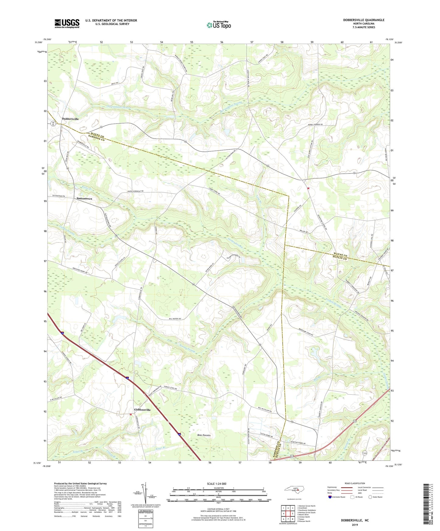
2022 topographic map quadrangle Dobbersville in the state of North Carolina. Scale: 1:24000. Based on the newly updated USGS 7.5' US Topo map series, this map is in the following counties: Sampson, Wayne, Duplin. The map contains contour data, water features, and other items you are used to seeing on USGS maps, but also has updated roads and other features. This is the next generation of topographic maps. Printed on high-quality waterproof paper with UV fade-resistant inks.
Quads adjacent to this one:
West: Newton Grove South
Northwest: Newton Grove North
North: Grantham
Northeast: Southwest Goldsboro
East: Mount Olive
Southeast: Warsaw North
South: Faison
Southwest: Clinton North
This map covers the same area as the classic USGS quad with code o35078b2.
Contains the following named places: Bear Pocosin, Bethlehem Church, Brownings Church, Clifton Branch, Concord Church, Dobbersville, Giddensville, Goshen Church, Hines School, Kings Church, Kings School, Long Branch, Mill Branch, Piney Grove Fire Department, Railer Branch, Saint Lukes Church, Saints Delight Church, Skeeter Point, Smith Chapel, Smith Chapel Volunteer Fire Department - Wayne County Station 25, Suttons Store, Suttontown, Suttontown Rescue Squad, Thunder Swamp, Township of Piney Grove, Wesley Church, Youngs Swamp