MyTopo
Gilreath North Carolina US Topo Map
Couldn't load pickup availability
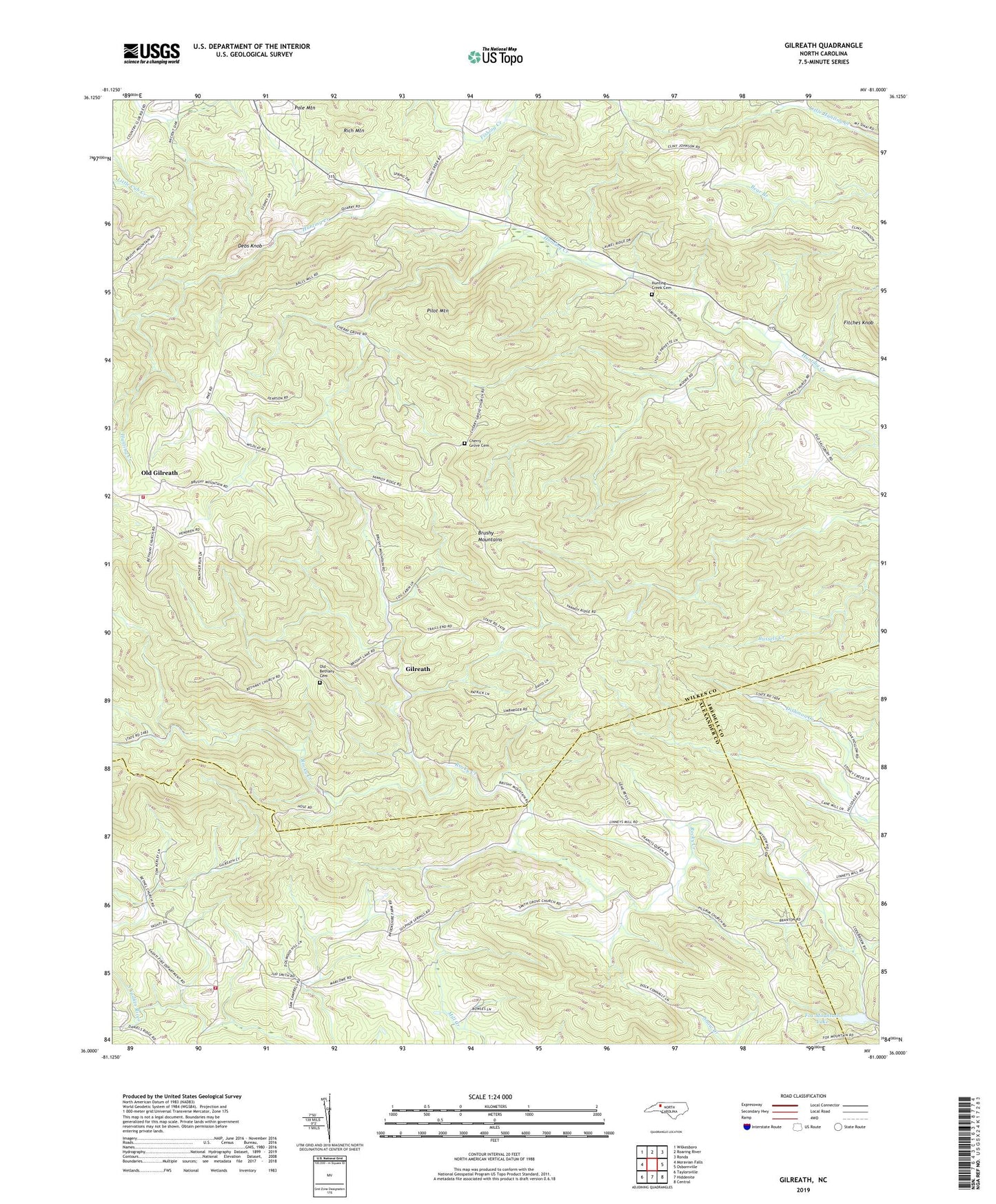
2022 topographic map quadrangle Gilreath in the state of North Carolina. Scale: 1:24000. Based on the newly updated USGS 7.5' US Topo map series, this map is in the following counties: Wilkes, Alexander, Iredell. The map contains contour data, water features, and other items you are used to seeing on USGS maps, but also has updated roads and other features. This is the next generation of topographic maps. Printed on high-quality waterproof paper with UV fade-resistant inks.
Quads adjacent to this one:
West: Moravian Falls
Northwest: Wilkesboro
North: Roaring River
Northeast: Ronda
East: Osbornville
Southeast: Central
South: Hiddenite
Southwest: Taylorsville
This map covers the same area as the classic USGS quad with code o36081a1.
Contains the following named places: Bakers Grove Church, Bethany Church, Bethel Church, Big R Orchards, Brushy Mountain Volunteer Fire Department, Cherry Grove Baptist Church, Cherry Grove Cemetery, Christ Church, D H Orchards, Deater Dam, Debs Knob, Dwight Baity Dam, Fox Mountain Lake, Fox Mountain Lake Dam, Gilreath, Gilreath School, Hendren Mill, Hunting Creek, Hunting Creek Cemetery, Hunting Creek Church, Kennedy Store, Lewis Church, Liberty Church, Lowell Hendren Orchards, Mount Sinai Church, New Hope Church, Noname, Old Bethany Cemetery, Old Gilreath, Parker's Orchard, Pilot Mountain, Pole Mountain, Rich Mountain, Smiths Grove Church, Spurgeon, Tevepaugh Orchards, Township of Brushy Mountain, Township of Lovelace, Vashti Volunteer Fire Department