MyTopo
Grist Mountain North Carolina US Topo Map
Couldn't load pickup availability
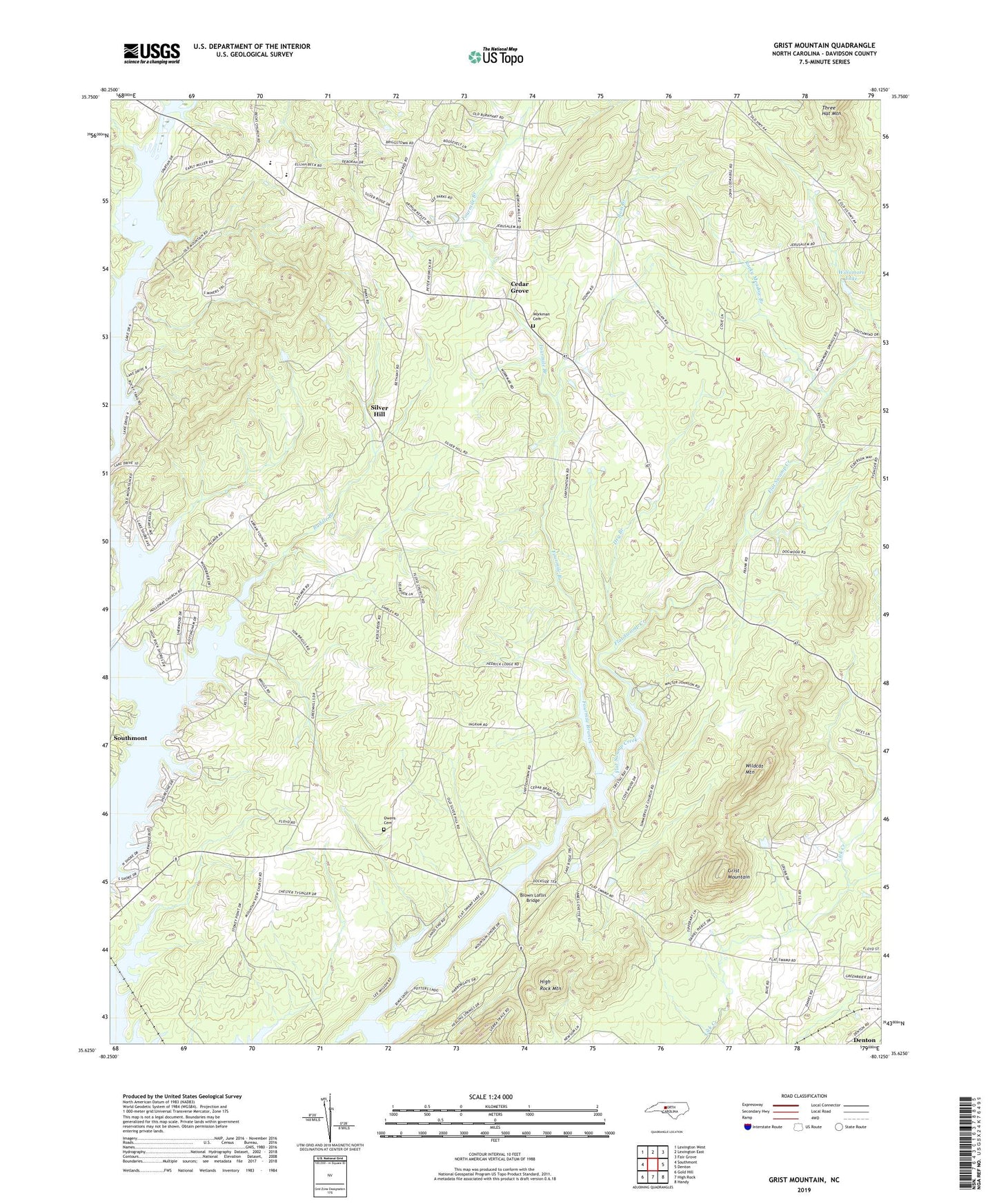
2022 topographic map quadrangle Grist Mountain in the state of North Carolina. Scale: 1:24000. Based on the newly updated USGS 7.5' US Topo map series, this map is in the following counties: Davidson. The map contains contour data, water features, and other items you are used to seeing on USGS maps, but also has updated roads and other features. This is the next generation of topographic maps. Printed on high-quality waterproof paper with UV fade-resistant inks.
Quads adjacent to this one:
West: Southmont
Northwest: Lexington West
North: Lexington East
Northeast: Fair Grove
East: Denton
Southeast: Handy
South: High Rock
Southwest: Gold Hill
This map covers the same area as the classic USGS quad with code o35080f2.
Contains the following named places: Bending Brook, Bethany United Methodist Church, Boss Branch, Brown Loflin Bridge, Buddle Branch, Cedar Grove, Cedar Grove Baptist Church, Central Davidson High School, Central Davidson Junior High School, Dry Branch, Faith Church, Floyd Baptist Church, Fourmile Branch, Grist Mountain, Grubbs Grove Church, High Rock Mountain Shores, Holloways Baptist Church, Mountain View Baptist Church, New Jerusalem United Church of Christ, Oakwood Acres, Owens Cemetery, Poplar College, Rocky Meadow, Rocky Meadow Branch, Silver Hill, Silver Valley Baptist Church, Silver Valley Volunteer Fire Department Station 92, Snider Mill, Summerville Baptist Church, Township of Healing Spring, Township of Silver Hill, Wildcat Mountain, Willomore Lake, Workman Cemetery, ZIP Code: 27292