MyTopo
High Rock North Carolina US Topo Map
Couldn't load pickup availability
Also explore the High Rock Forest Service Topo of this same quad for updated USFS data
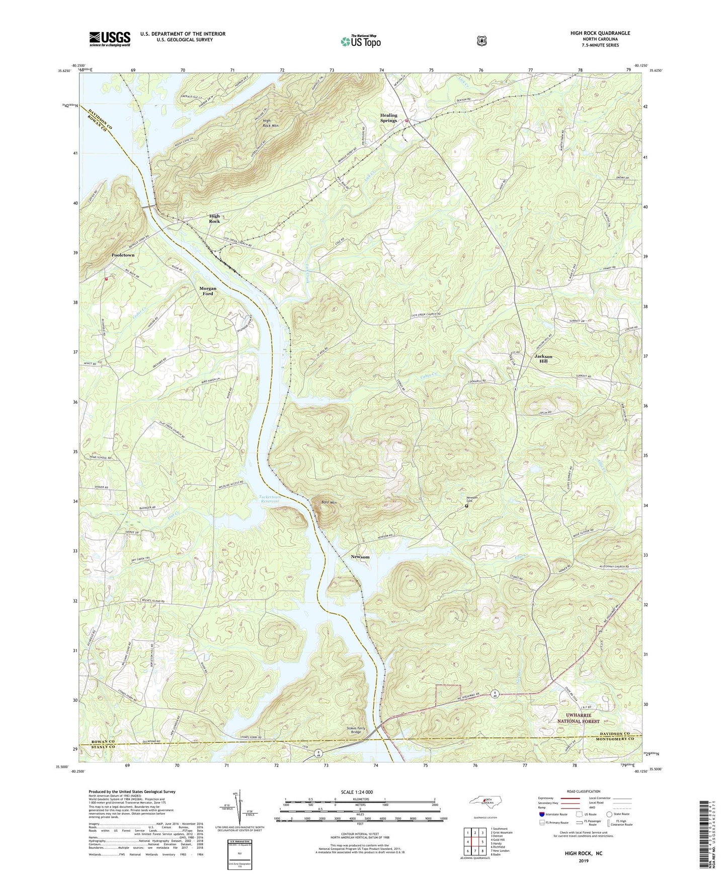
2022 topographic map quadrangle High Rock in the state of North Carolina. Scale: 1:24000. Based on the newly updated USGS 7.5' US Topo map series, this map is in the following counties: Davidson, Rowan, Montgomery, Stanly. The map contains contour data, water features, and other items you are used to seeing on USGS maps, but also has updated roads and other features. This is the next generation of topographic maps. Printed on high-quality waterproof paper with UV fade-resistant inks.
Quads adjacent to this one:
West: Gold Hill
Northwest: Southmont
North: Grist Mountain
Northeast: Denton
East: Handy
Southeast: Badin
South: New London
Southwest: Richfield
This map covers the same area as the classic USGS quad with code o35080e2.
Contains the following named places: Alleghany Church, Antioch Church, Bald Mountain, Bringle Ferry, Cabin Creek, Cedar Creek, Chandler Grove Church, Clear Springs Church, Ellis Creek, FirstHealth of the Carolinas Emergency Medical Services Base 7, Flat Creek, Flat Creek Church, Flat Swamp Creek, Healing Springs, Healing Springs Fire Department Station 48, High Rock, High Rock Baptist Church, High Rock Lake, High Rock Lake Dam, High Rock Mountain, Jackson Hill, Lick Creek, Lick Creek Baptist Church, Luthers Church, Millerton, Morgan Ford, Newsom, Newsom Cemetery, Pleasant Grove Church, Pooletown, Pooletown Volunteer Fire Department Station 69, Riles Creek, Stokes Ferry, Stokes Ferry Bridge, Taylor Grove Church, Township of Alleghany, Township of Jackson Hill, Tuckertown Reservoir, ZIP Code: 28137