MyTopo
Jasper North Carolina US Topo Map
Couldn't load pickup availability
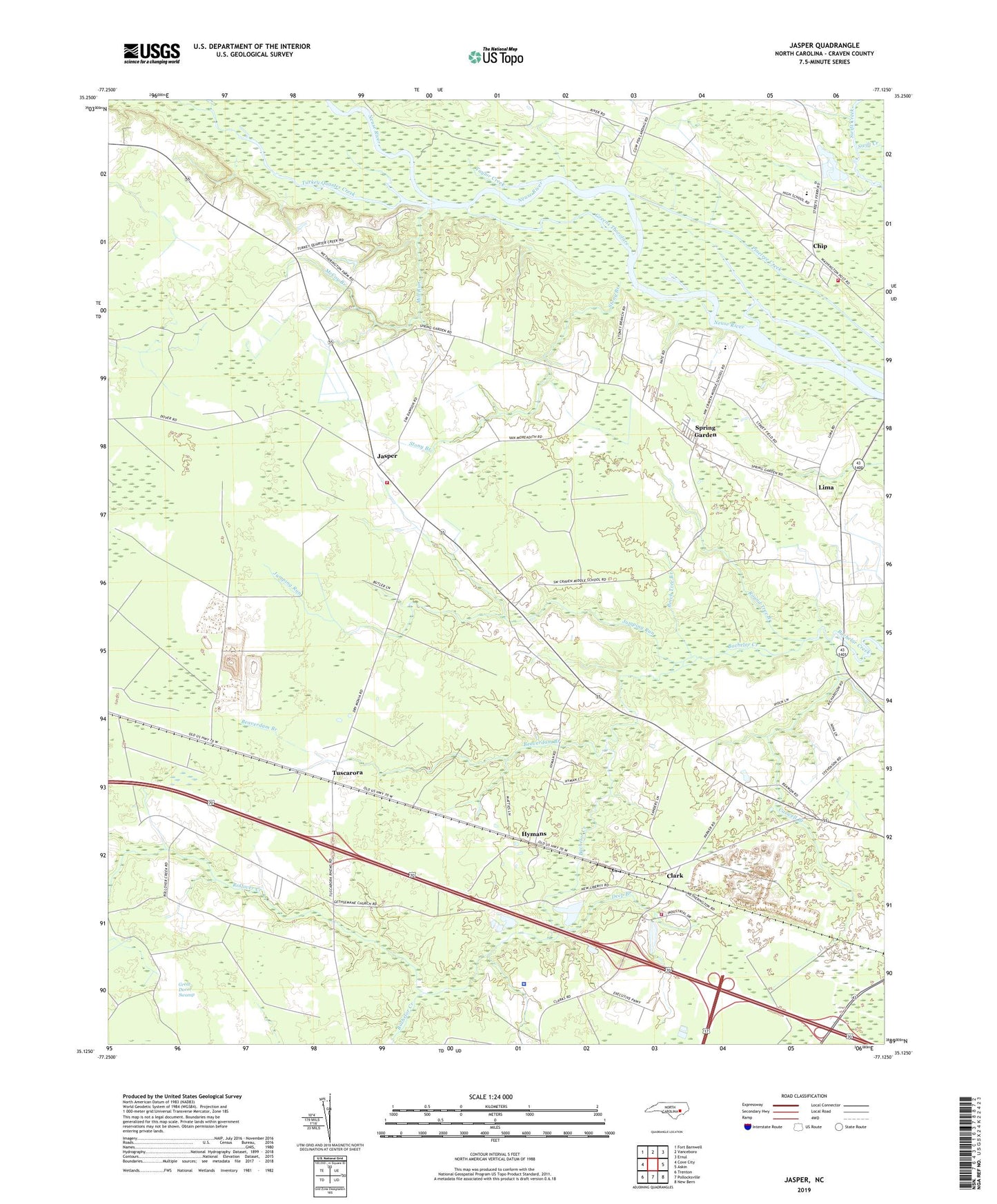
2019 topographic map quadrangle Jasper in the state of North Carolina. Scale: 1:24000. Based on the newly updated USGS 7.5' US Topo map series, this map is in the following counties: Craven. The map contains contour data, water features, and other items you are used to seeing on USGS maps, but also has updated roads and other features. This is the next generation of topographic maps. Printed on high-quality waterproof paper with UV fade-resistant inks.
Quads adjacent to this one:
West: Cove City
Northwest: Fort Barnwell
North: Vanceboro
Northeast: Ernul
East: Askin
Southeast: New Bern
South: Pollocksville
Southwest: Trenton
Contains the following named places: Archdale County, Beaverdam Branch, Beech Tree Branch, Bethany Church, Caswell Branch, Chip, Clark, Cowpen Landing, Craven County Sheriff's Office, Deep Branch, Gethsemane Church, Greens Thorofare, Hymans, Jasper, Jasper Elementary School, Jumping Run, Lima, McCoy Branch, Mill Branch, Mill Run, New Bern - Craven County Rescue Squad, Number 9 Township Fire and Rescue, Red Wood Terrace Mobile Home Park, Redhill Landing, Rio Grande Church, Rollover Creek, Round Tree Branch, Saint Jones Church, Saint Marks Church, Shell Landing, Spring Garden, Spring Garden Church, Spring Garden Landing, Stony Branch, Taylor Creek, Township 9, Turkey Quarter Creek, Tuscarora, Vanceboro Volunteer Fire Department, WBIC-AM (Trent Woods), West Craven Junior High School, West of New Bern Volunteer Fire Department - Station 3