MyTopo
Guilford North Carolina US Topo Map
Couldn't load pickup availability
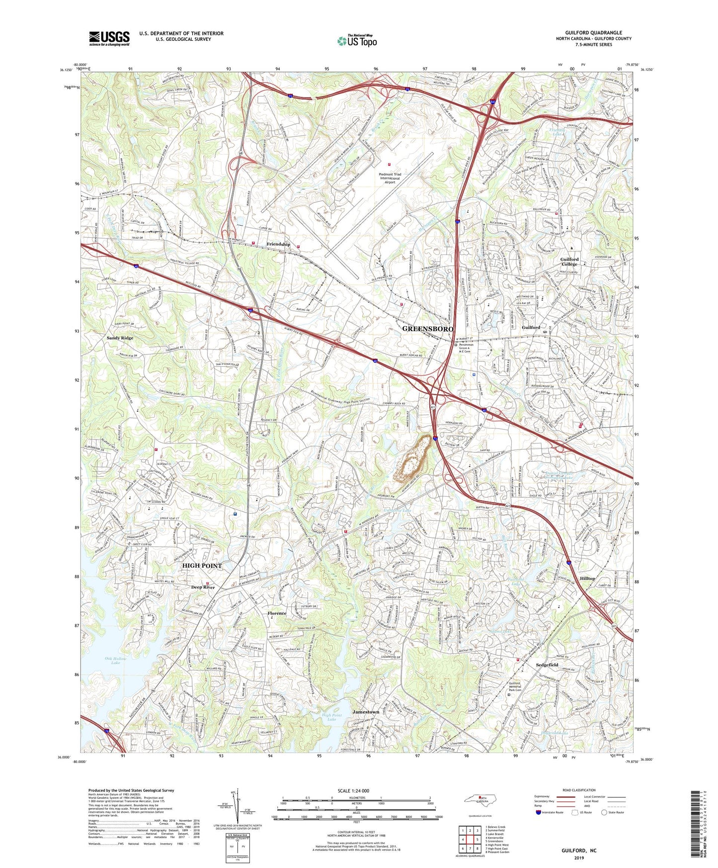
2022 topographic map quadrangle Guilford in the state of North Carolina. Scale: 1:24000. Based on the newly updated USGS 7.5' US Topo map series, this map is in the following counties: Guilford. The map contains contour data, water features, and other items you are used to seeing on USGS maps, but also has updated roads and other features. This is the next generation of topographic maps. Printed on high-quality waterproof paper with UV fade-resistant inks.
Quads adjacent to this one:
West: Kernersville
Northwest: Belews Creek
North: Summerfield
Northeast: Lake Brandt
East: Greensboro
Southeast: Pleasant Garden
South: High Point East
Southwest: High Point West
This map covers the same area as the classic USGS quad with code o36079a8.
Contains the following named places: Adams Farm, Adams Lake, Adams Lake Dam, Beechcroft, Daniel Lumber Company Lake, Daniel Lumber Company Lake Dam, Deep River, Dogwood Lake, Dogwood Lake Dam, East Fork Deep River, Fairfield Lake, Fairfield Lake Dam, Florence, Florence Elementary School, Freemon Lake, Freemon Lake Dam, Friendly Lake, Friendly Lake Dam, Friendship, Friendship Church, Friendswood, Greensboro Fire Department Station 18, Greensboro Fire Department Station 19, Greensboro Fire Department Station 20, Greensboro Fire Department Station 52, Greensboro Police Department - Division 3, Guilford, Guilford College, Guilford County Emergency Services, Guilford Memorial Park Cemetery, Guilford Middle School, Guilford Post Office, Guilford Primary School, Hiatt Branch, High Point Deep River Fire Station 12, High Point Fire Department Station 10, High Point Fire Department Station 11, High Point Lake, Hillside Lake, Hillside Lake Dam, Hilltop, Jefferson Gardens, Long Branch, Madison Woods, Midway Church, New Salem Tabernacle, Oak Hollow Dam, Oak Hollow Lake, Oaks West, Persimmon Grove A M E Cemetery, Persimmon Grove Church, Piedmont Triad Airport Authority Fire Rescue Department, Piedmont Triad International Airport, Pilot Life Dam, Pinecroft - Sedgefield Fire District Station 23, Ponoma Quarry, Quaker Acres, Raleigh Crossroads Church, Reynolds Chapel, Sandy Ridge, Sedgefield, Sedgefield Country Club, Sedgefield Lakes, Smiths Grove Church, Southwest Elementary School, Southwest High School, Township of Friendship, Upper Colonial Dam, Upper Colonial Lake, Uwharrie Council Camp, Uwharrie Lake, Uwharrie Lake Dam, Western Guilford High School, WQFS-FM (Greensboro), ZIP Codes: 27407, 27409, 27410