MyTopo
Old Dock North Carolina US Topo Map
Couldn't load pickup availability
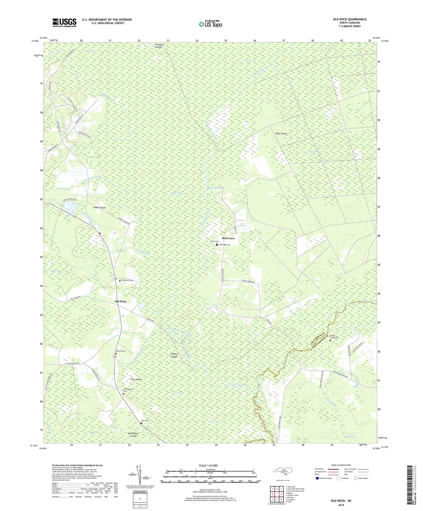
2022 topographic map quadrangle Old Dock in the state of North Carolina. Scale: 1:24000. Based on the newly updated USGS 7.5' US Topo map series, this map is in the following counties: Columbus, Brunswick. The map contains contour data, water features, and other items you are used to seeing on USGS maps, but also has updated roads and other features. This is the next generation of topographic maps. Printed on high-quality waterproof paper with UV fade-resistant inks.
Quads adjacent to this one:
West: Nakina
Northwest: Whiteville
North: Lake Waccamaw West
Northeast: Lake Waccamaw East
East: Juniper Creek
Southeast: Exum
South: Freeland
Southwest: Pireway
This map covers the same area as the classic USGS quad with code o34078b5.
Contains the following named places: Bear Branch, Blackmon Cemetery, Boggy Swamp, Buck Island, Clewis Cemetery, Clifton Island, Cross Swamp, Crusoe Community Hall, Duncan Cemetery, Etheridge Cemetery, Formyduval Cemetery, Gum Swamp, Gum Swamp Run, Honey Field, Juniper Creek, Lee Lake, Little Swamp, Macedonia Church, Magnolia Church, Mark Pine Bay, Mark Pine Canal, Mill Branch, Myrtle Head Cemetery, Myrtle Head Church, Old Dock, Old Dock - Cypress Creek Volunteer Fire Department and Auxiliary, Old Dock Church, Old Dock Elementary School, Old Dock School, Palmyra Church, Pine Island, Ready Branch, Riverview, Ross Cemetery, Schulkens Pond, Shiloh Church, Snake Island, South Old Dock, Sweetgum Island, The Fishponds, Township of Lees, White Marsh