MyTopo
Lemon Gap North Carolina US Topo Map
Couldn't load pickup availability
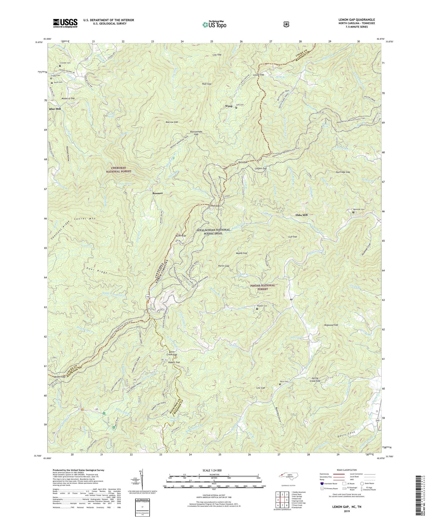
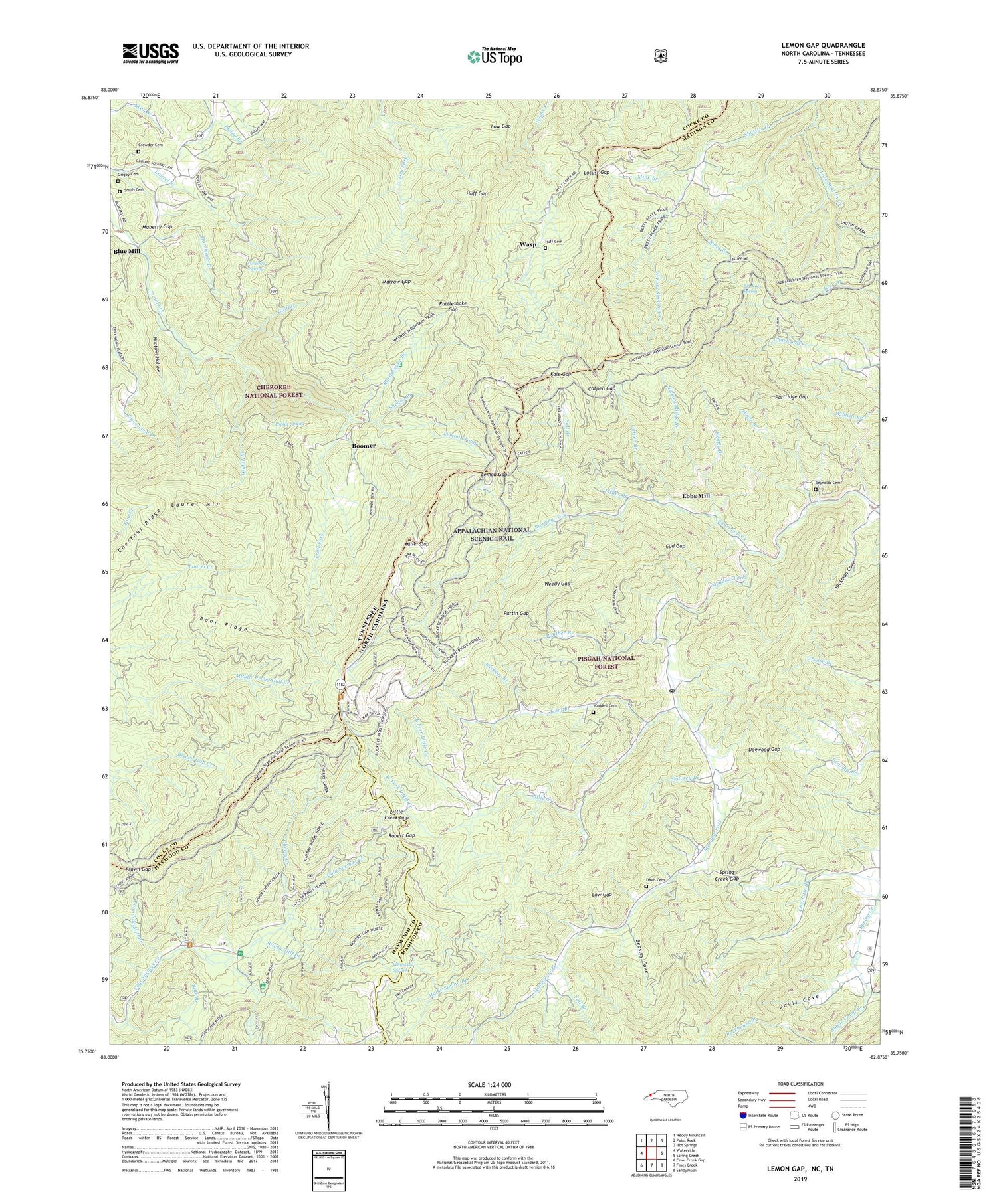
2019 topographic map quadrangle Lemon Gap in the states of North Carolina, Tennessee. Scale: 1:24000. Based on the newly updated USGS 7.5' US Topo map series, this map is in the following counties: Madison, Cocke, Haywood. The map contains contour data, water features, and other items you are used to seeing on USGS maps, but also has updated roads and other features. This is the next generation of topographic maps. Printed on high-quality waterproof paper with UV fade-resistant inks.
Quads adjacent to this one:
West: Waterville
Northwest: Neddy Mountain
North: Paint Rock
Northeast: Hot Springs
East: Spring Creek
Southeast: Sandymush
South: Fines Creek
Southwest: Cove Creek Gap
Contains the following named places: Balding Chapel, Bear Branch, Beasley Cove, Bethel Church, Big Rock Spring, Blue Mill, Bluff Mountain, Bonnie Hill Church, Boomer, Brown Gap, Brushy Mountain, Brushy Ridge, Buckeye Branch, Buckeye Ridge, Catpen Branch, Catpen Gap, Cherry Creek, Chestnut Ridge, Crowder Cemetery, Cud Gap, Davis Cemetery, Davis Cove, Dixon Mountain, Dogwood Gap, Double Branch, Duckett Top, East Fork Little Creek, Ebbs Mill, Fall Branch, Fisher Branch, Garenflo Gap, Grigby Cemetery, Gulf Branch, Hickman Cove, Hickory Ridge Branch, Hogback Mountain, Hootowl Hollow, Hopis Branch, Huff Cemetery, Huff Gap, Hurricane Branch, Jack Trail Mountain, Joe Post Office, Jones Branch, Junebug Spring, Kale Gap, Keener School, Laurel Mountain, Lemon Gap, Lemon Prong, Little Creek, Little Creek Gap, Little Fall Branch, Locust Gap, Long Branch, Low Gap, Lynch, Maple Spring Branch, Marrow Gap, Max Patch Mountain, Meadow Fork School, Miller Gap, Miller Gap School, Mink Branch, Moccasin Gap, Muberry Church, Muberry Gap, New Prospect Church, Panther Branch, Panther Knob, Partin Gap, Partridge Gap, Partridge Gap Ridge, Piney Mountain, Poor Ridge, Poplar Gap School, Poplar Spring, Pounding Mill Branch, Rattlesnake Branch, Rattlesnake Branch Recreation Area, Rattlesnake Gap, Raven Cliff Branch, Reynolds Cemetery, Rich Mountain, Roaring Fork, Roaring Fork Mountain, Roaring Fork School, Robert Gap, Round Mountain, Round Mountain Campground, Round Mountain Lookout, Shavrey Branch, Shelton Branch, Skiffly Branch, Smith Cemetery, Snaggy Point, Spring Creek Gap, Sugar Camp Branch, Tennessee Bluff, Township 8-Spring Creek, Trail Ridge, Waddell Cemetery, Walnut Mountain, Walnut Mountain Appalachian Trail Shelter, Walnut Mountain Trail, Wasp, Weedy Gap, West Fork Little Creek, West Fork Shut-In Creek, Whiteoak Spring, ZIP Code: 28743