MyTopo
Midway North Carolina US Topo Map
Couldn't load pickup availability
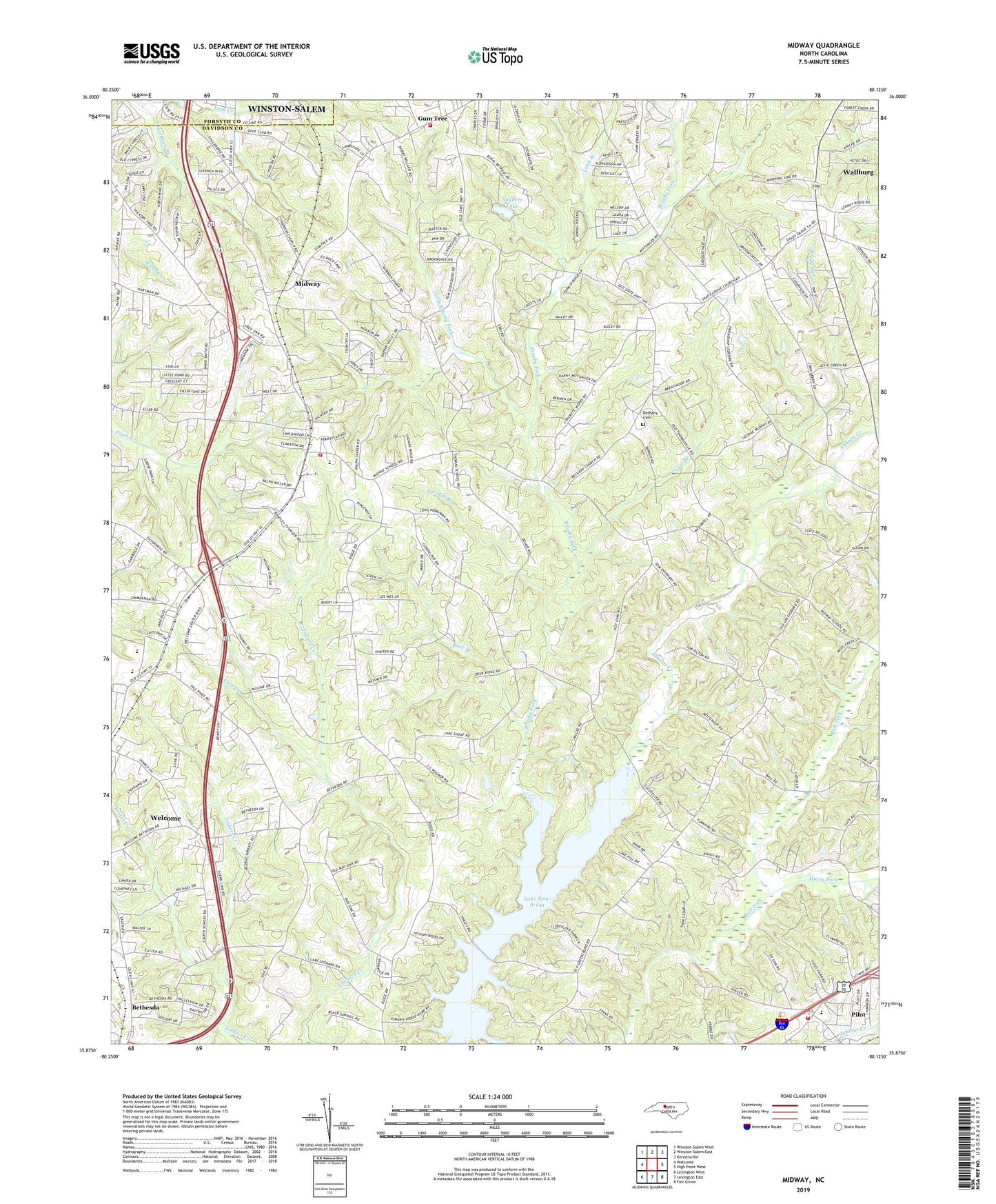
2019 topographic map quadrangle Midway in the state of North Carolina. Scale: 1:24000. Based on the newly updated USGS 7.5' US Topo map series, this map is in the following counties: Davidson, Forsyth. The map contains contour data, water features, and other items you are used to seeing on USGS maps, but also has updated roads and other features. This is the next generation of topographic maps. Printed on high-quality waterproof paper with UV fade-resistant inks.
Quads adjacent to this one:
West: Welcome
Northwest: Winston-Salem West
North: Winston-Salem East
Northeast: Kernersville
East: High Point West
Southeast: Fair Grove
South: Lexington East
Southwest: Lexington West
Contains the following named places: Ashmore Business College, Bethany, Bethany Cemetery, Bethany Church, Bethesda, Bethesda United Methodist Church, Bethlehem United Church of Christ, Brooks Temple, Brushy Fork, Buck Branch, Cain Creek, Canaan Methodist Church, Cool Branch, Easter Creek, Ebenezers, Fairview Methodist Church, Faith Alliance Church, Friendship Elementary School, Gates Church, Gum Tree, Gumtree Fire and Rescue, Hebron Church, Hilltop Baptist Church, Hunts Fork, Lake Tom-A-Lex, Ledford Senior High School, Little Brushy Fork, Long Branch, Midway, Midway Baptist Church, Midway Christian Church, Midway Elementary School, Midway Fire and Rescue Department Station 86, Mount Pleasant Church, North Davidson High School, North Davidson Junior High School, Oil Mill Branch, Our Saviours Church, Pilot, Pilot Elementary School, Pilot Fire Department Station 54, Reedy Run, Rich Fork Church, Ridgeview Acres, Saints Delite Church, Shady Grove Methodist Church, Snyders Lake, Snyders Lake Dam, The Oaks, Town of Midway, Town of Wallburg, Township of Midway, Victory Baptist Church