MyTopo
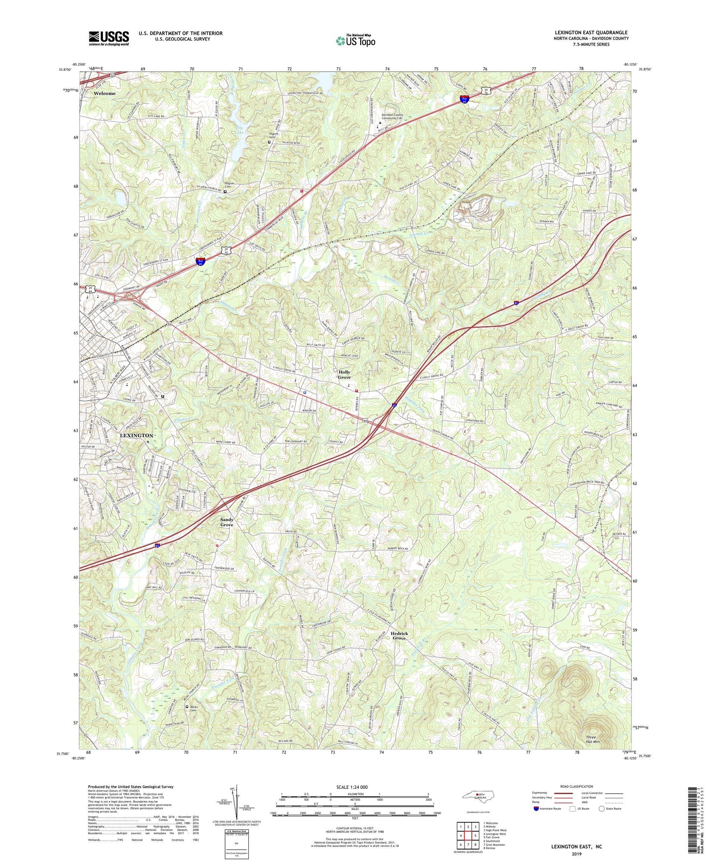
Lexington East North Carolina US Topo Map
Couldn't load pickup availability
2022 topographic map quadrangle Lexington East in the state of North Carolina. Scale: 1:24000. Based on the newly updated USGS 7.5' US Topo map series, this map is in the following counties: Davidson. The map contains contour data, water features, and other items you are used to seeing on USGS maps, but also has updated roads and other features. This is the next generation of topographic maps. Printed on high-quality waterproof paper with UV fade-resistant inks.
Quads adjacent to this one:
West: Lexington West
Northwest: Welcome
North: Midway
Northeast: High Point West
East: Fair Grove
Southeast: Denton
South: Grist Mountain
Southwest: Southmont
This map covers the same area as the classic USGS quad with code o35080g2.
Contains the following named places: Arbor Acres, Arlington Heights Free Will Baptist Church, Becks Cemetery, Becks Lutheran Church, Becks Reformed Church, Bingham Tennis Court, Bryans Woods, Cecil School, Central Volunteer Fire Department Station 37, Church of Christ, Church of God, City Lake, Clearview Baptist Church, Colonial Heights, Country Club Estates, Cunningham Baptist Church, Davidson Correctional Center, Davidson County, Davidson County Emergency Medical Services Base 1, Davidson County Sheriff's Office, Davidson Plaza Shopping Center, Davis-Townsend Elementary School, Dunbar School, East End Baptist Church, East Fourth Street Park, Eastern Heights, Eaves Primary School, Finch Park, Free Pilgrim Church, Gethsemane Baptist Temple, Grace Alliance Church, Hamby Creek, Heath Church, Hedrick Grove, Hedricks Grove United Church of Christ, Holly Grove, Holly Grove Baptist Church, Holly Grove Fire Department, Homestead Acres, Jefferson Village, Jimes, Jimmys Creek, Lake, Lake Tom-A-Lex Dam, Leonard Creek, Lexington Middle School, Lexington Senior High School, Lexington Storage Reservoir Dam, Mayers Quarry, Memorial United Church of Christ, Mount Tabor United Church of Christ, North Lexington Triangle Fire Department Station 64, North Pugh, Old Becks Church, Pilgrim Cemetery, Pilgrim Free Will Baptist Church, Pilgrim Lutheran Church, Pilgrim Reformed United Church of Christ, Pounder Fork, Raleigh Road Park, Rich Fork, Ridgewood Acres, Sandy Grove, South Cecil, State Prison Camp Number 602, Thomasville Quarry, Three Hat Mountain, Tinkers Creek, Township of Conrad Hill, Tussy Street, Twin Acres, Twin Oaks, Wayside Tabernacle Church, WBUY-AM (Lexington), WLXN-FM (Lexington)