MyTopo
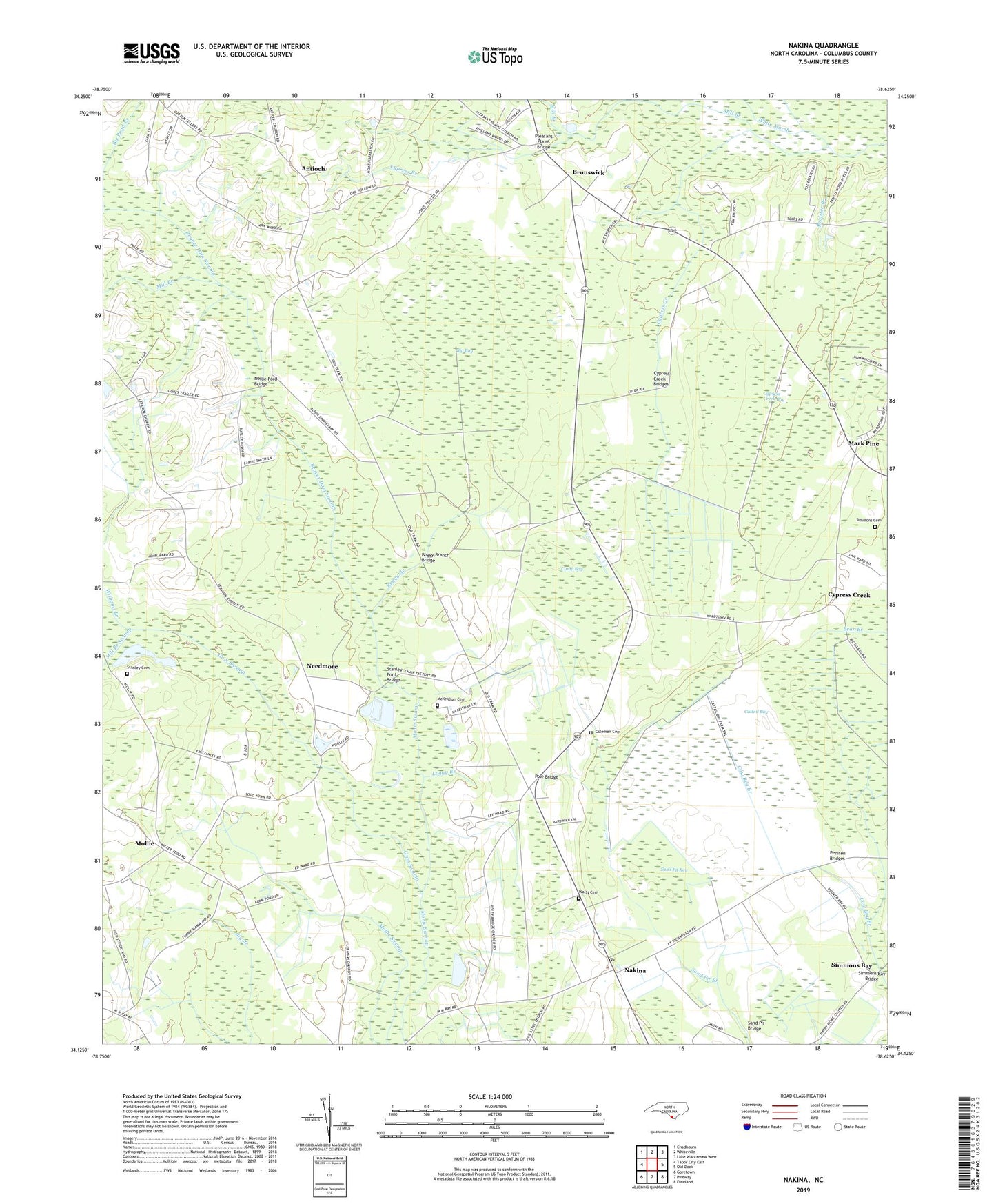
Nakina North Carolina US Topo Map
Couldn't load pickup availability
2022 topographic map quadrangle Nakina in the state of North Carolina. Scale: 1:24000. Based on the newly updated USGS 7.5' US Topo map series, this map is in the following counties: Columbus. The map contains contour data, water features, and other items you are used to seeing on USGS maps, but also has updated roads and other features. This is the next generation of topographic maps. Printed on high-quality waterproof paper with UV fade-resistant inks.
Quads adjacent to this one:
West: Tabor City East
Northwest: Chadbourn
North: Whiteville
Northeast: Lake Waccamaw West
East: Old Dock
Southeast: Freeland
South: Pireway
Southwest: Goretown
This map covers the same area as the classic USGS quad with code o34078b6.
Contains the following named places: Antioch, Antioch Church, Beaver Dam Swamp, Big Bay, Boggy Branch, Boggy Branch Bridge, Camp Bay, Campside Church, Cattail Bay, Chadwick Church, Coleman Cemetery, Cow Bog Branch, Cypress Branch, Cypress Creek, Cypress Creek Bay, Cypress Creek Bridges, Faith Church, Gum Swamp, Lebanon Branch, Loggy Branch, Mark Pine, McKeithan Cemetery, Mill Branch, Mill Branch Swamp, Mollie, Mollie Swamp, Monroe Stanley Cemetery, Nakina, Nakina Post Office, Needmore, Nellie Ford Bridge, Peniten Bridges, Peniten Canal, Pleasant Meadow Church, Pleasant Plains, Pleasant Plains Bridge, Pleasant Plains Church, Pole Bridge, Poley Bridge Church, Poley Bridge Crossing, Register Branch, Sand Pit Bay, Sand Pit Bridge, Simmons Bay, Simmons Bay Bridge, Simmons Bay Creek, Simmons Cemetery, Stanley Ford Bridge, Sweet Home Church, Ward Corner, Watts Cemetery, Whites Crossing, Williams Branch