MyTopo
Polkton North Carolina US Topo Map
Couldn't load pickup availability
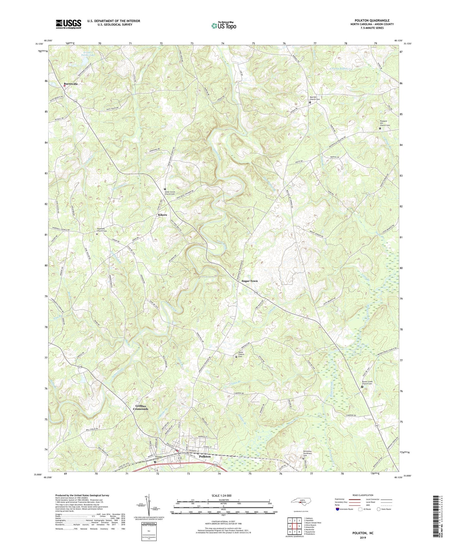
2022 topographic map quadrangle Polkton in the state of North Carolina. Scale: 1:24000. Based on the newly updated USGS 7.5' US Topo map series, this map is in the following counties: Anson. The map contains contour data, water features, and other items you are used to seeing on USGS maps, but also has updated roads and other features. This is the next generation of topographic maps. Printed on high-quality waterproof paper with UV fade-resistant inks.
Quads adjacent to this one:
West: Olive Branch
Northwest: Oakboro
North: Aquadale
Northeast: Mount Gilead West
East: Ansonville
Southeast: Wadesboro
South: Russellville
Southwest: Marshville
This map covers the same area as the classic USGS quad with code o35080a2.
Contains the following named places: Big Branch, Brown Creek Church, Brown Creek Church Cemetery, Burnsville, Burnsville Fire and Rescue Service, Cabin Branch, Canebreak Branch, Cedar Branch, Cedar Grove Church, Cedar Grove Church Cemetery, Cranes Branch, D and J Farms Lake, D and J Farms Lake Dam, Deep Bottom Branch, Flag Branch, Griffins Crossroads, Haileys Branch, Hopewell Church, Hopewell Church Cemetery, Jacks Branch, Kikers, Lanesboro Fire District, Little Brown Creek, Little Cribs Creek, Mount Vernon Church, Oak Dale Church, Pinch Gut Creek, Pleasant Hill Church, Pleasant Hill Church Cemetery, Polkton, Polkton Post Office, Red Hill Church, Red Hill Church Cemetery, Richmond - Sturdivant Cemetery, Rocky Branch, Saron Church, Saron Church Cemetery, Sugar Town, Town of Polkton, Township of Burnsville, Williams Cemetery, ZIP Code: 28135