MyTopo
Old Sparta North Carolina US Topo Map
Couldn't load pickup availability
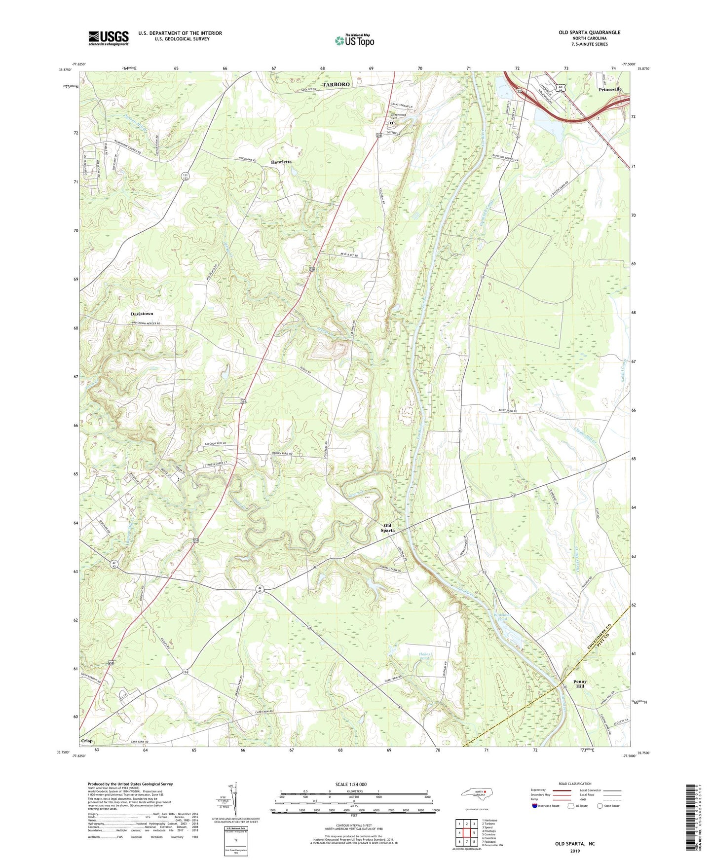
2019 topographic map quadrangle Old Sparta in the state of North Carolina. Scale: 1:24000. Based on the newly updated USGS 7.5' US Topo map series, this map is in the following counties: Edgecombe, Pitt. The map contains contour data, water features, and other items you are used to seeing on USGS maps, but also has updated roads and other features. This is the next generation of topographic maps. Printed on high-quality waterproof paper with UV fade-resistant inks.
Quads adjacent to this one:
West: Pinetops
Northwest: Hartsease
North: Tarboro
Northeast: Speed
East: Conetoe
Southeast: Greenville NW
South: Falkland
Southwest: Fountain
Contains the following named places: Bynum Mill Creek, Canoe Landing, Cedar Grove Church, Cheeks Mill Creek, Cobbs Crossroads, Cromwell Canal, Davistown, Edgecombe Memorial Park, Grace Chapel, Henrietta, Hokes Pond, Hokes Pond Dam, Jerrys Creek, Knight Canal, Lawrences Landing, Little Mill Landing, Mount Zion Church, Old Sparta, Penny Hill, Saint Luke Church, Scotts Crossroads, South Edgecombe Rural Fire Department, Stantons Mill, Suggs Crossroads, Suggs Landing, Town Creek, Township 8-Sparta, William Chapel, Winslows Pond, Winslows Pond Dam, Zion Chapel