MyTopo
South Mills North Carolina US Topo Map
Couldn't load pickup availability
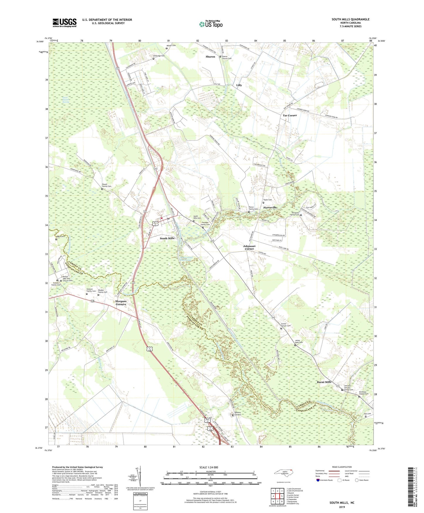
2022 topographic map quadrangle South Mills in the state of North Carolina. Scale: 1:24000. Based on the newly updated USGS 7.5' US Topo map series, this map is in the following counties: Camden, Pasquotank, Currituck. The map contains contour data, water features, and other items you are used to seeing on USGS maps, but also has updated roads and other features. This is the next generation of topographic maps. Printed on high-quality waterproof paper with UV fade-resistant inks.
Quads adjacent to this one:
West: Lynchs Corner
Northwest: Lake Drummond
North: Lake Drummond SE
Northeast: Moyock
East: Lambs Corner
Southeast: Elizabeth City
South: Pasquotank
Southwest: Chapanoke
This map covers the same area as the classic USGS quad with code o36076d3.
Contains the following named places: Abbott Cemetery, Antioch Church, Archie Sawyer Cemetery, Bethel AME Zion Church Cemetery, Bethel Church, Burnt Mills, Cartwright Pit, Ebenezer Church, Etheridge Cemetery, Fauna, Ferebee Family Cemetery, Geneva Church, Hall Cemetery, Jackson Corner, James Nash Cemetery, Joes Island Creek, Johnsons Corner, Joyce Creek, Koen Cemetery, Lebanon Mobile Home Park, Lemuel Sawyer Family Cemetery, Lilly, Lock Number 2, McBride Church, Memory Gardens, Mill Pond Creek, Morgans Corners, Newland Church, Oak Grove Church, Pierce Family Cemetery, Pierceville, Powell Family Cemetery, Rhodes Family Cemetery, Sharon, Sharon Church Cemetery, Smithson - Tisdale Cemetery, Smithson Landing, South Mills, South Mills Cemetery, South Mills Census Designated Place, South Mills Post Office, South Mills Volunteer Fire Department, Stewart Family Cemetery, Stokely Family Cemetery, Tar Corner, Taylor Cemetery, Township of South Mills, Trinity Church, Turners Cut, WS Jones Family Cemetery, ZIP Code: 27976