MyTopo
Persimmon Creek North Carolina US Topo Map
Couldn't load pickup availability
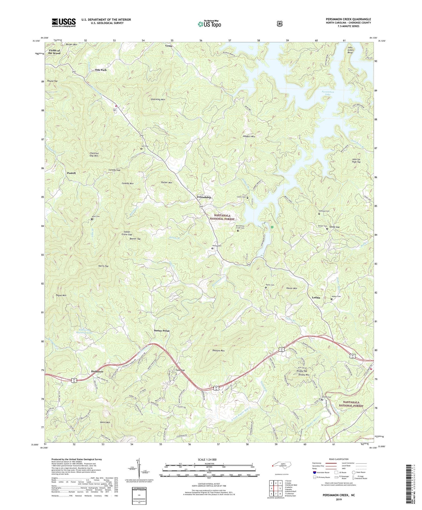
2019 topographic map quadrangle Persimmon Creek in the state of North Carolina. Scale: 1:24000. Based on the newly updated USGS 7.5' US Topo map series, this map is in the following counties: Cherokee. The map contains contour data, water features, and other items you are used to seeing on USGS maps, but also has updated roads and other features. This is the next generation of topographic maps. Printed on high-quality waterproof paper with UV fade-resistant inks.
Quads adjacent to this one:
West: Isabella
Northwest: Farner
North: Unaka
Northeast: McDaniel Bald
East: Murphy
Southeast: Nottely Dam
South: Culberson
Southwest: Mineral Bluff
Contains the following named places: Allen Branch, Allen Cemetery, Bear Paw, Bearpaw Church, Bearpen Creek, Beaver Top, Bell Hill Church, Burger Mountain, Canedy Gap, Canedy Mountain, Cherokee County Emergency Medical Services Station 3, Chestnut Gap Mountain, Clonts Cemetery, Cole Gap, Damons Mountain, Decker Cemetery, Dickey Branch, Dickey Cemetery, Dickey Mountain, Dickey Top, Flax Creek, Flax Creek Church, Friendship, Garland Branch, Ghormley Mountain, Harris Chapel, Harris Top, Hibbert Branch, Hibbert Mountain, Hickey Branch, Hickey Cemetery, Hideaway Mountain Lake, Hideaway Mountain Lake Dam, Hiwassee Dam Fire Department, Hiwassee Dam School, Hopewell Church, Hothouse, Indian Grave Gap, Jack Davis Branch, John Green Bend, John Ish High Top, Kirkland Cemetery, Lake Cherokee, Lake Cherokee Picnic Area, Lake Cherokee Recreation Site, Letitia, Mount Carmel Church, Mount Pleasant Church, Nealy Gap, North Fork Rapier Mill Creek, Oak Grove Church, Oak Park, Parker Mountain, Payne Mountain, Persimmon Creek, Persimmon Creek Cemetery, Persimmon Dam, Persimmon Lake, Pied Piper Dam Lower, Pied Piper Dam Upper, Pied Piper Lake Lower, Pied Piper Lake Upper, Postell, Ranger Church, Ranger School, Ranger Volunteer Fire Department, Rapier Mill Creek, Round Top, Sandy Gap, Sandy Gap Dam Number One, Sandy Gap Dam Number Two, Sandy Gap Lake Number One, Sandy Gap Lake Number Two, Shady Grove Church, Shields, Shuler Mountain, Stiles Mountain, Suit Cemetery, Sunny Point, Taylor Cemetery, Ten Commandments, Thompson Branch, Township of Shoal Creek, Vance Mountain, Vests, Walker Plantation Cemetery, ZIP Code: 28906