MyTopo
Sanville Virginia US Topo Map
Couldn't load pickup availability
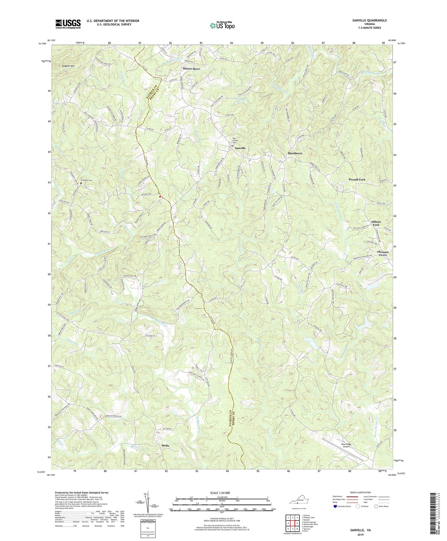
2022 topographic map quadrangle Sanville in the state of Virginia. Scale: 1:24000. Based on the newly updated USGS 7.5' US Topo map series, this map is in the following counties: Henry, Patrick. The map contains contour data, water features, and other items you are used to seeing on USGS maps, but also has updated roads and other features. This is the next generation of topographic maps. Printed on high-quality waterproof paper with UV fade-resistant inks.
Quads adjacent to this one:
West: Patrick Springs
Northwest: Charity
North: Philpott Lake
Northeast: Bassett
East: Martinsville West
Southeast: Price
South: Spencer
Southwest: Nettleridge
This map covers the same area as the classic USGS quad with code o36080f1.
Contains the following named places: Anthony School, Antioch Church, Blackberry, Blackberry Baptist Church, Blackberry District, Blue Ridge Airport, Brown School, Bull Run, Center School, Clark School, Coleman School, County Line Church, Dillons Fork, Fryes Store, Gethsemane Church, Goodwill Cemetery, Goodwill Church, Grassy Branch, Grays Fork, Hales Ponds, Happy Branch, Hogpen Mountain, Horse Pasture Creek Number Two Dam, Horse Pasture Dam Number 1c, Koger, Kogers Mill, Laurel Branch, Mayo Church, Mayo River District, Mount Calvary Church, Mount Nemo Church, Mount Olive Church, Mount Pleasant School, Old Center Cemetery, Old Center Church, Pannill Fork, Patrick - Henry Volunteer Fire Department, Philpott School, Pleasant Grove, Pleasant Grove Christian Church, Pleasant View Church, Polebridge Creek, Rock Hill Church, Salem Church, Sanville, Sanville Elementary School, Spencer Creek, Stella, Stones Store, Trent Farm Airstrip, Via School, Whitts Branch, Wood School