MyTopo
Sunshine North Carolina US Topo Map
Couldn't load pickup availability
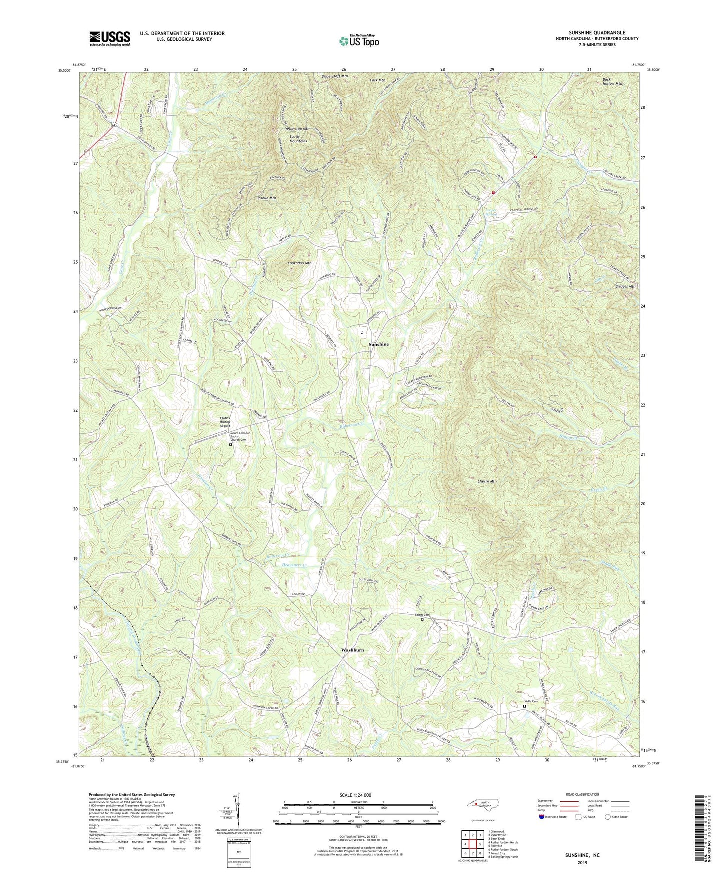
2019 topographic map quadrangle Sunshine in the state of North Carolina. Scale: 1:24000. Based on the newly updated USGS 7.5' US Topo map series, this map is in the following counties: Rutherford. The map contains contour data, water features, and other items you are used to seeing on USGS maps, but also has updated roads and other features. This is the next generation of topographic maps. Printed on high-quality waterproof paper with UV fade-resistant inks.
Quads adjacent to this one:
West: Rutherfordton North
Northwest: Glenwood
North: Dysartsville
Northeast: Benn Knob
East: Polkville
Southeast: Boiling Springs North
South: Forest City
Southwest: Rutherfordton South
Contains the following named places: Adkins Mine, Andrews Mill, Bridges Mountain, Buck Hollow Mountain, Carlyle Mill, Carpenters Store, Cedar Grove Church, Center School, Cherry Mountain, Cherry Mountain Church, Cherry Mountain Volunteer Fire Department, Clute's Hilltop Airport, Cooper Springs, Cooper Springs Church, Feltons Mill, Gurleys Store, Heaveners Creek, Hunting Creek, Joshua Mountain, Lanes Store, Longs Store, Lookadoo Mountain, Mount Harmony Church, Mount Lebanon Baptist Church Cemetery, Mount Lebanon Church, Mount View Church, Mountain Creek, New Vernon Church, Roberson Creek Church, Salem Cemetery, Salem Church, Sandy Level Church, Sunshine, Sunshine Church, Thompsons Store, Township of Logan Store, Walls Cemetery, Walls Church, Washburn, Wilson Church, Wilsons School, Yellowtop Mountain, ZIP Codes: 28018, 28040