MyTopo
Tapoco North Carolina US Topo Map
Couldn't load pickup availability
Also explore the Tapoco Forest Service Topo of this same quad for updated USFS data
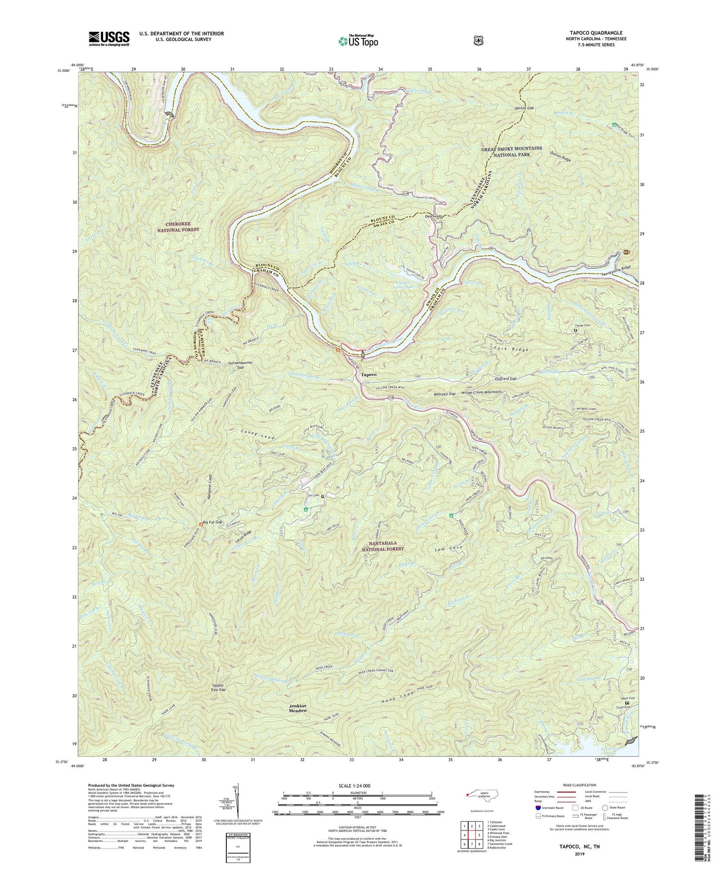
2022 topographic map quadrangle Tapoco in the states of North Carolina, Tennessee. Scale: 1:24000. Based on the newly updated USGS 7.5' US Topo map series, this map is in the following counties: Graham, Monroe, Swain, Blount. The map contains contour data, water features, and other items you are used to seeing on USGS maps, but also has updated roads and other features. This is the next generation of topographic maps. Printed on high-quality waterproof paper with UV fade-resistant inks.
Quads adjacent to this one:
West: Whiteoak Flats
Northwest: Tallassee
North: Calderwood
Northeast: Cades Cove
East: Fontana Dam
Southeast: Robbinsville
South: Santeetlah Creek
Southwest: Big Junction
Contains the following named places: Aiken Branch, Attooga Branch, Barker Creek, Beach Creek, Bear Creek, Bear Creek Hunter Camp, Bearpen Gap, Beers School, Bethel Church, Big Fat Branch, Big Fat Gap, Blackgum Branch, Buckeye Branch, Buggy Branch, Calderwood Dam, Calderwood Lake, Caney Branch, Caney Lead, Chedah Dam, Cheoah Dam, Cheoah Lake, Cheoah River, Cheoah Valley Dam, Cheoah Valley Lake, Clat Branch, Cochran Creek, Cold Spring Knob, Coom Cemetery, Cooper Camp Branch, Dalton Gap, Dalton Gap Branch, Dalton Ridge, Deals Branch, Deals Gap, Deep Creek, Deep Creek Hunter Camp, Falls Branch, Farley Cemetery, First Creek, Fishtrap Branch, Fork Ridge, Forneys Creek Township, Frisby Branch, Glen Gap Branch, Goat Creek, Gold Mine Branch, Grapevine Branch, Grassy Branch, Halfmile Branch, Hangover Creek, Hangover Lead, Haoe Lead, Hudson Deaden Branch, Ike Branch, Indian Grave Branch, Jane Branch, Jenkins Meadow, Joyce Kilmer-Slickrock Wilderness, Judy Branch, Laurel Branch, Lifting Rock Branch, Little Blackgum Branch, Little Laurel Branch, Little Slickrock Creek, Locust Ridge, Lowdown Branch, Lower Falls, Magazine Branch, Maple Springs Observation Point, Meadow Branch, Middle Creek, Naked Ground, Naked Ground Branch, Nichols Cove Branch, Odom Cemetery, Oldfield Gap, Orr Cemetery, Otter Rack Branch, Parson Branch, Persimmon Tree Branch, Pole Bridge Branch, Primitive Church, Puncheon Camp Branch, Rock Creek, Rock Creek Knob, Rockwall Branch, Rocky Point Ferry Branch, Rough Branch, Rust Branch, Saddle Tree Gap, Sam Cove, Santeetlah Dam, Shaw Grave Branch, Sheep Wallow Knob, Slickrock Creek, State Line Branch, Stillhouse Branch, Stratton Branch, Sugar Cove Branch, Tapoco, Township of Yellow Creek, Tunnel Branch, Twentymile Creek, Wildcat Branch, Yellow Creek, Yellowhammer Branch, Yellowhammer Gap