MyTopo
Townsville North Carolina US Topo Map
Couldn't load pickup availability
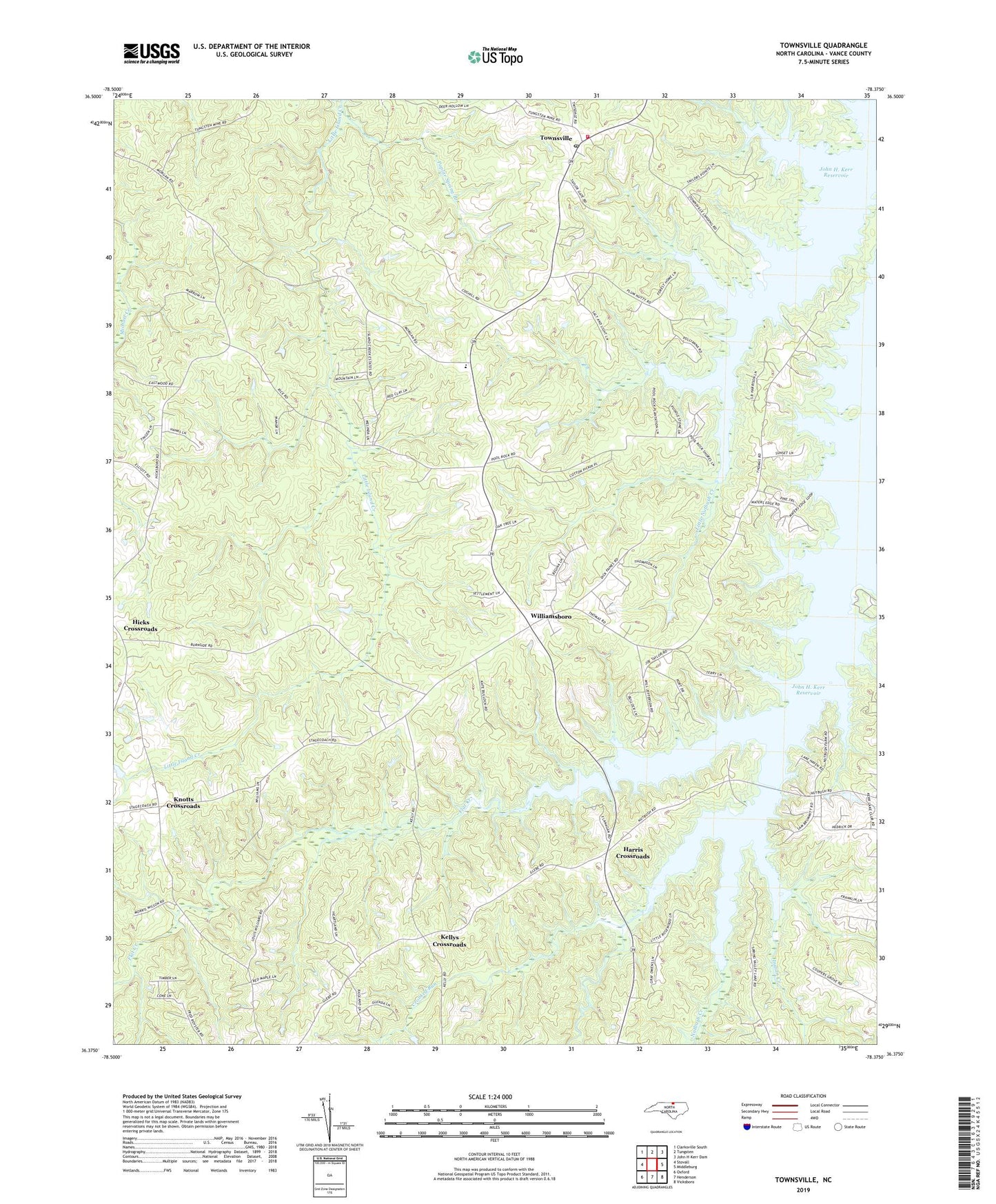
2022 topographic map quadrangle Townsville in the state of North Carolina. Scale: 1:24000. Based on the newly updated USGS 7.5' US Topo map series, this map is in the following counties: Vance. The map contains contour data, water features, and other items you are used to seeing on USGS maps, but also has updated roads and other features. This is the next generation of topographic maps. Printed on high-quality waterproof paper with UV fade-resistant inks.
Quads adjacent to this one:
West: Stovall
Northwest: Clarksville South
North: Tungsten
Northeast: John H Kerr Dam
East: Middleburg
Southeast: Vicksboro
South: Henderson
Southwest: Oxford
This map covers the same area as the classic USGS quad with code o36078d4.
Contains the following named places: Ashley Grove Church, Cedar Walk, Crooked Run, Flat Creek, Flat Creek Church, Hargrove Estates, Harris Crossroads, Hicks Crossroads, Hope Place, Indian Creek, Island Creek Church, Island Creek Estates, Kellys Crossroads, Kerr Lake Country Club, Kerr Lake School, Kerr Lake State Recreation Area, Knotts Crossroads, Marrows Chapel, Montpelier Airport, Mount Calvary Church, Mount Zion Church, New Hope School, Nutbush Bridge Campground, Nutbush Church, Philadelphia Church, Poplar Spring Branch, Saint Beulahs Church, Saint Johns Church, Thomas Satterwhite House, Township of Williamsboro, Townsville, Townsville Landing, Townsville Post Office, Townsville Volunteer Fire Department, Williamsboro, Williamsboro Wayside