MyTopo
Stovall North Carolina US Topo Map
Couldn't load pickup availability
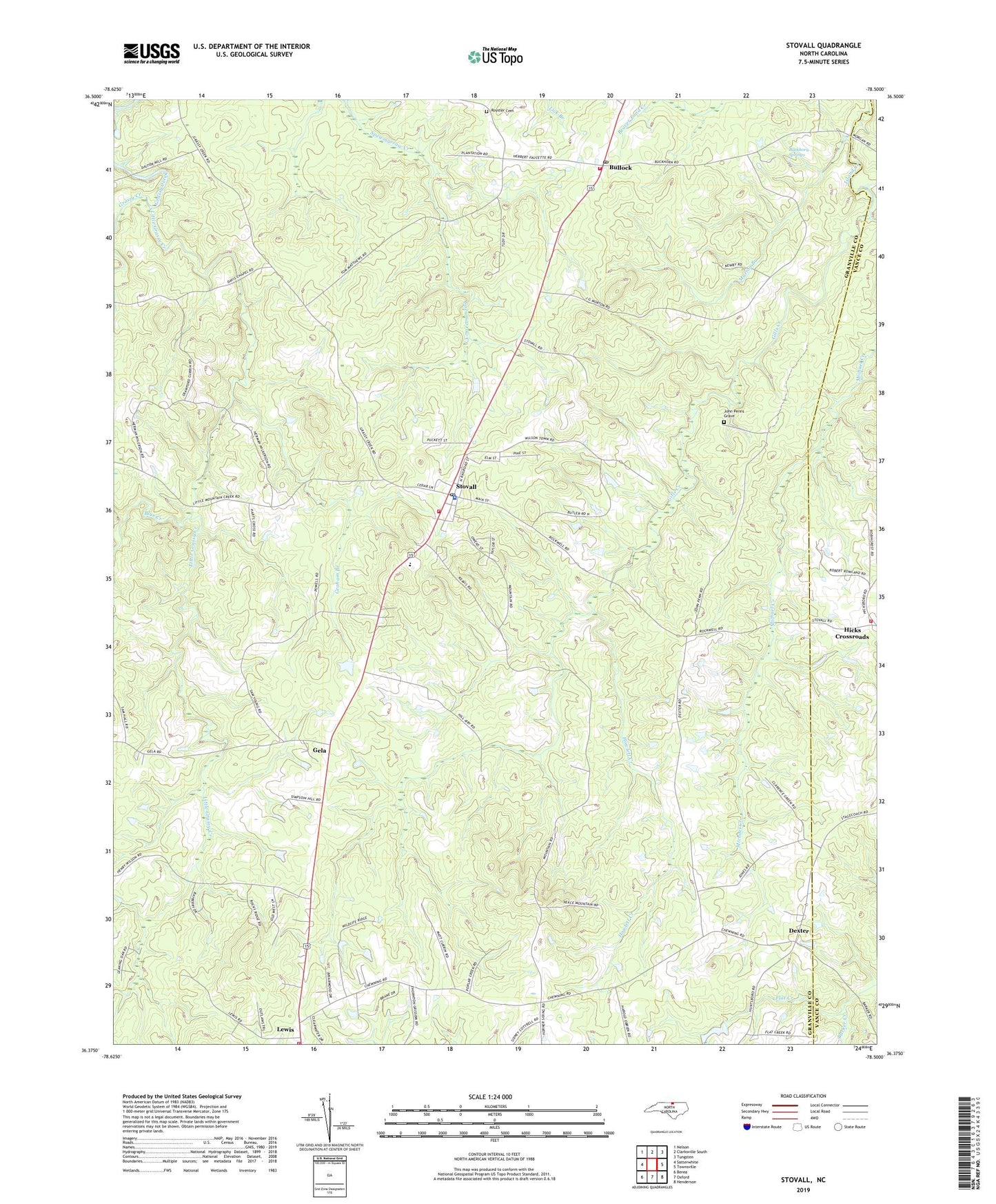
2022 topographic map quadrangle Stovall in the state of North Carolina. Scale: 1:24000. Based on the newly updated USGS 7.5' US Topo map series, this map is in the following counties: Granville, Vance. The map contains contour data, water features, and other items you are used to seeing on USGS maps, but also has updated roads and other features. This is the next generation of topographic maps. Printed on high-quality waterproof paper with UV fade-resistant inks.
Quads adjacent to this one:
West: Satterwhite
Northwest: Nelson
North: Clarksville South
Northeast: Tungsten
East: Townsville
Southeast: Henderson
South: Oxford
Southwest: Berea
This map covers the same area as the classic USGS quad with code o36078d5.
Contains the following named places: Barker Creek, Barry Gold School, Blue Creek, Buckhorn Springs, Bullock, Bullock Post Office, Bullock Volunteer Fire Department, Chapel Hill Church, Davis Chapel, Dexter, Gela, Gills Creek, Graham Branch, Granville County Emergency Medical Services Station 3, Granville Rural Volunteer Fire Department, Grassy Creek Church, Hicksboro Fire and Emergency Management Services - Station 1, Howlett Creek, John Penns Grave, Lewis, Little Grassy Creek, Marion Branch, Michael Creek, Michael Creek Church, Michel School, Mountain School, Oxford Monastery, Royster Cemetery, Stovall, Stovall Fire Department, Stovall Police Department, Stovall Post Office, Stovall School, Stovall-Shaw School, Town of Stovall, Township of Salem, Township of Sassafras Fork, Young Zion School, Zorra Chapel, ZIP Code: 27582