MyTopo
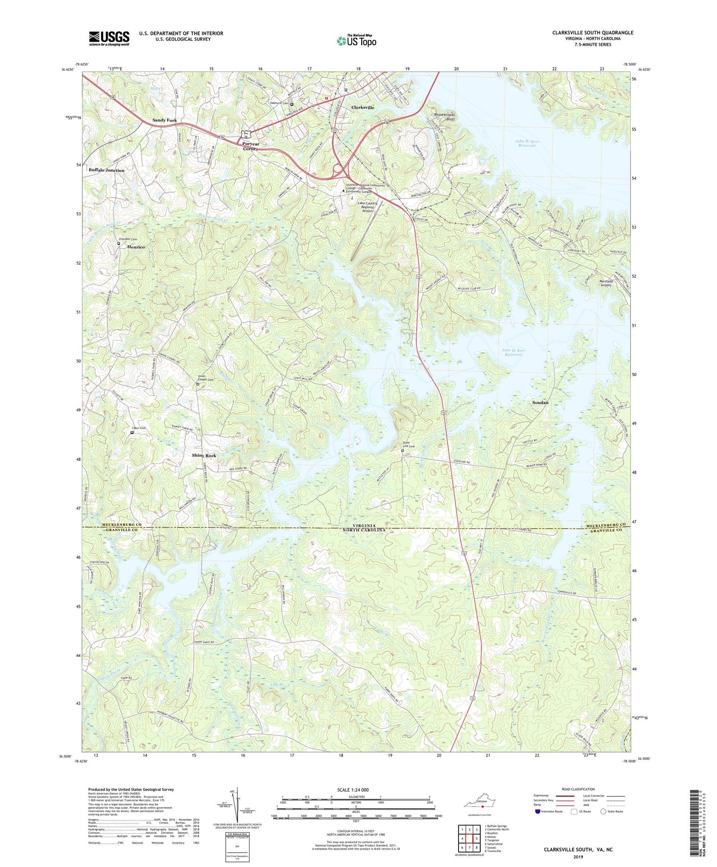
Clarksville South Virginia US Topo Map
Couldn't load pickup availability
2022 topographic map quadrangle Clarksville South in the states of Virginia, North Carolina. Scale: 1:24000. Based on the newly updated USGS 7.5' US Topo map series, this map is in the following counties: Mecklenburg, Granville, Vance. The map contains contour data, water features, and other items you are used to seeing on USGS maps, but also has updated roads and other features. This is the next generation of topographic maps. Printed on high-quality waterproof paper with UV fade-resistant inks.
Quads adjacent to this one:
West: Nelson
Northwest: Buffalo Springs
North: Clarksville North
Northeast: Boydton
East: Tungsten
Southeast: Townsville
South: Stovall
Southwest: Satterwhite
This map covers the same area as the classic USGS quad with code o36078e5.
Contains the following named places: Aarons Creek Farm, Beaver Pond Creek, Beaver Pond Creek Wildlife Management Area, Beech Creek, Black Creek, Blanks, Blue Creek, Buckhorn Branch, Camp Concord, Cedar Branch, Chandler Cemetery, Clarksville, Clarksville Baptist Church, Clarksville Crossing Shopping Center, Clarksville Elementary School, Clarksville Marina, Clarksville Police Department, Clarksville Presbyterian Church, Clarksville Volunteer Fire Department, Cozy Cabin, Crowders Branch, Distillery Branch, Essex Branch, Grassy Creek, Grassy Creek Church, Grassy Creek Recreation Area, Henrico, Hillcrest School, Johnson Creek, Kinderton Country Club, Lake Country Regional Airport, Lewis Island, Lewis Mill, Lewis Mill Dam, Lick Branch, Ligon Cemetery, Little Beaver Pond Creek, Longwood Public Use Area, Meadow View Terrace Hospice, Mecklenburg County Life Saving and Rescue Squad, Merifield Acres, Merifield Airport, Merifield Wildlife Management Area, Mill Creek, Mill Village, Mount Ararat Church, Mount Ararat School, Oakhurst Cemetery, Old Soudan Wildlife Management Area, Puryear Corner, Rattlesnake Creek, Rosseechees Bluff, Saint Timothys Episcopal Church, Sandy Fork, Shiny Rock, Soudan, Spewmarrow Creek, State Line Cemetery, State Line Church, Tisdale Island, Town of Clarksville, Towns Mill Dam, Union Chapel, Union Chapel Cemetery, ZIP Codes: 23927, 27507


