MyTopo
Berea North Carolina US Topo Map
Couldn't load pickup availability
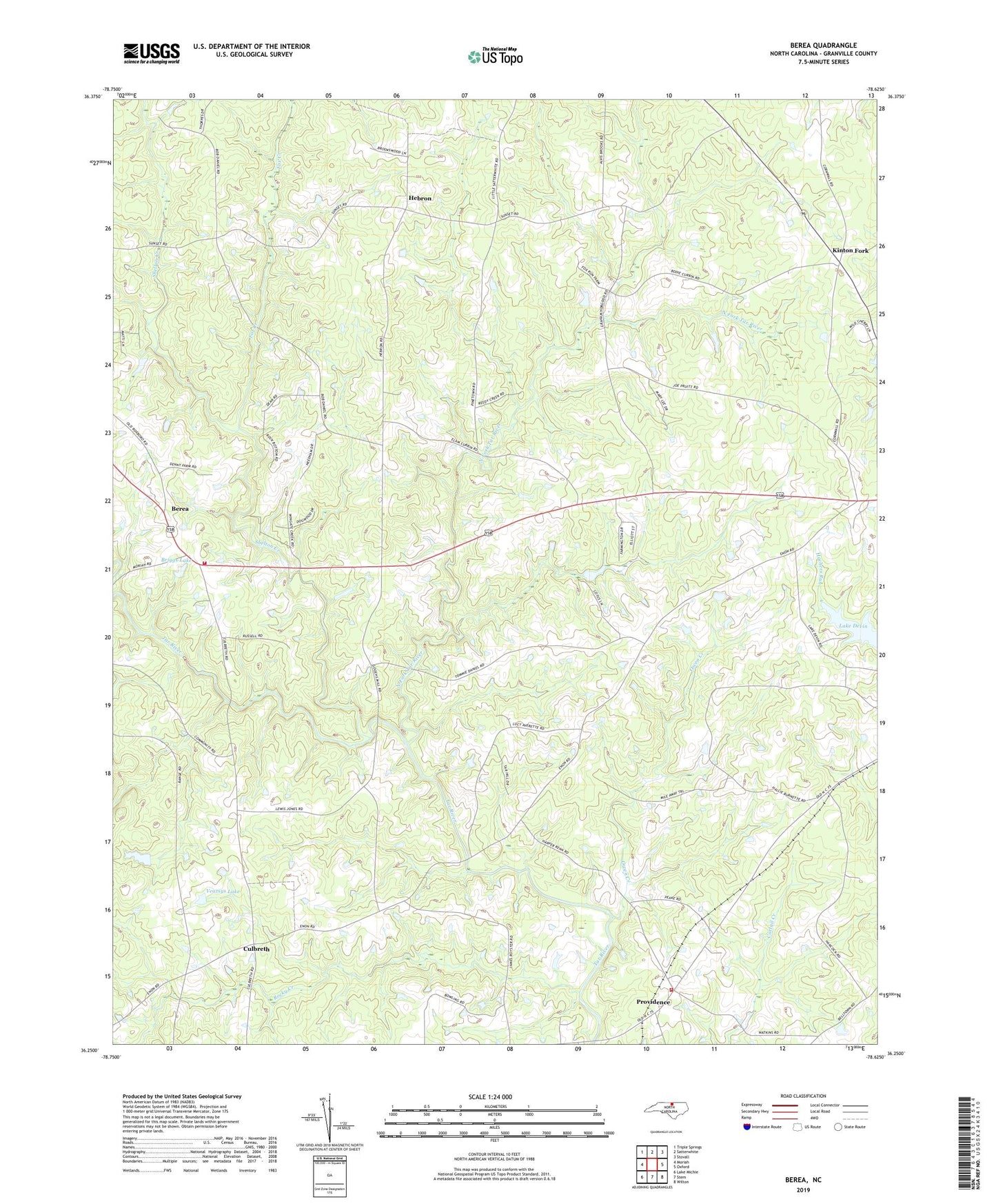
2022 topographic map quadrangle Berea in the state of North Carolina. Scale: 1:24000. Based on the newly updated USGS 7.5' US Topo map series, this map is in the following counties: Granville. The map contains contour data, water features, and other items you are used to seeing on USGS maps, but also has updated roads and other features. This is the next generation of topographic maps. Printed on high-quality waterproof paper with UV fade-resistant inks.
Quads adjacent to this one:
West: Moriah
Northwest: Triple Springs
North: Satterwhite
Northeast: Stovall
East: Oxford
Southeast: Wilton
South: Stem
Southwest: Lake Michie
This map covers the same area as the classic USGS quad with code o36078c6.
Contains the following named places: Berea, Berea Fire Department, Briggs Lake, Briggs Lake Dam, Culbreth, Enon Church, Fox Creek, Geneva Church, Granville County, Hachers Run, Hebron, Hebron Church, Hester Church, Huntsville Church, Huntsville School, Kinton Fork, Lake Devin, Mount Zion Church, Mountain Springs Church, New Hope Church, North Fork Tar River, Oak Grove Church, Oak Grove School, Olif Grove School, Olive Grove Church, Owen Creek, Providence, Providence Volunteer Fire Department, River Zion Church, Rocky Creek, Shelton Creek, Township of Walnut Grove, Veazsys Lake, Veazsys Lake Dam, Whites Lake, Whites Lake Dam, ZIP Code: 27565